- Shopping cart
- Checkout
- Order complete
You may be interested in…
Wyoming Elk Habitat Maps
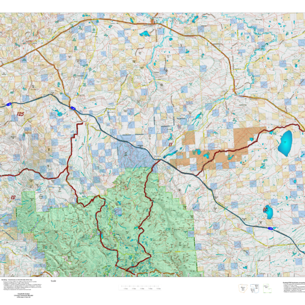
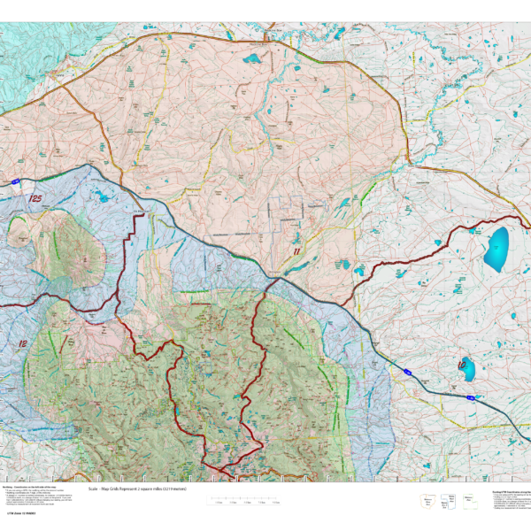
Unit boundaries where you can hunt but how do you figure out where you SHOULD? Hunt? We've taken the summer, winter, year-round and migration data from WG&F and projected it on newly updated Topo maps which include 7.5min USGS Roads and Trails from their Quad series. The maps are printed on our new rugged map fabric. Click Here to see the Wyoming Elk GMU Reference Map
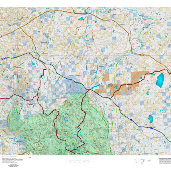
Wyoming Elk Land Ownership and Concentrations combined into one Hybrid map.
Over the years this has been our #1 requested map. This year, we used 5 different software processes to create the Colorado Elk Hybrid Map. This map is built on our NEW Land Ownership Maps. We then overlay a 7.5 minute (Quads) road layer from the USGS, add National Forest Roads, add lakes and streams from the USGS and then add the Colorado Parks and Wildlife summer, winter, and resident herd, migration routes and corridors for elk. For Mule Deer, we add summer and winter concentration areas. This map has it all. Its all printed on our rugged map fabric. The fabric has a translucency that brings the colors and information to life! This is truly the most comprehensive map we've produced in the past 25 years. Click on the small map at left to see a larger sample. Then, scroll to the bottom to order. Click Here to see the Wyoming Elk GMU Reference Map.
Will you be hunting Deer? Be sure to checkout our NEW! Wyoming Deer Land Ownership and Concentrations combined into one Hybrid map.
Will you be hunting Antelope? Be sure to checkout our NEW! Wyoming Antelope Land Ownership and Concentrations combined into one Hybrid map.