


Colorado Combo! 3 Elk Maps plus Digital 3D Maps.
$99.95
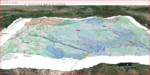
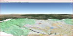
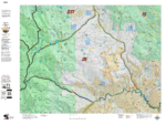
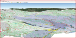
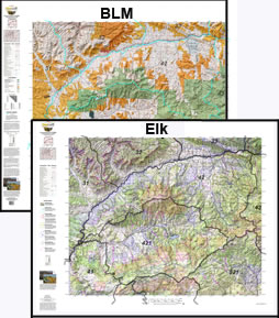
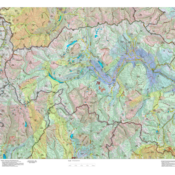
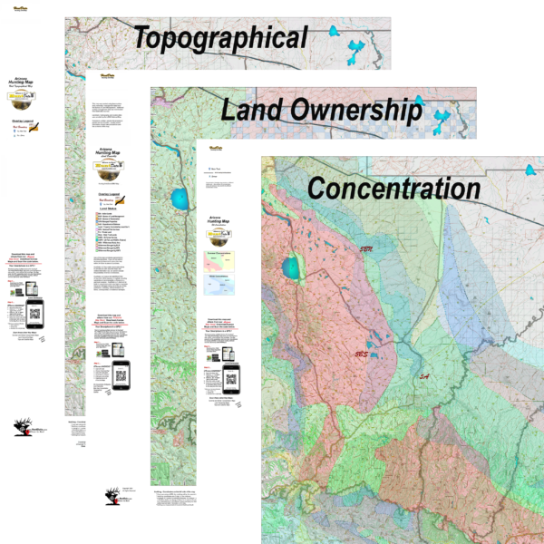
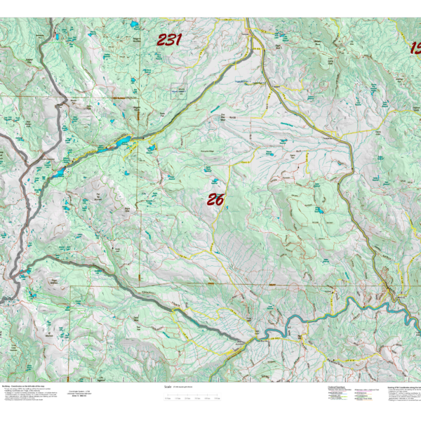
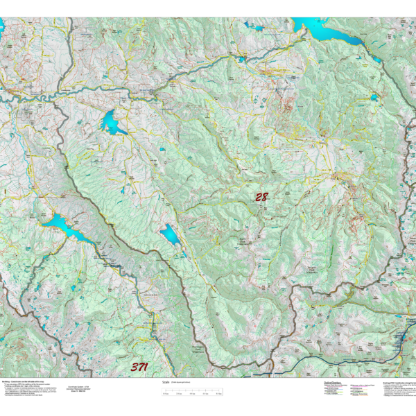
Land Ownership, Elk Concentration, and Topo Map. PLUS, 3D Digital Maps for Google Earth, to study during your Office Scouting! The Land Ownership and Elk Concentration Maps are printed on our rugged fabric material, the 3 Map “Hunting Pack” – Land Ownership and Elk Concentration Maps – are the ideal field guide for your hunting group! Click Here to see the Statewide GMU Reference Map. Check out samples of these maps under the Elk Concentration, Land Ownership and Topo Categories.
Additional information
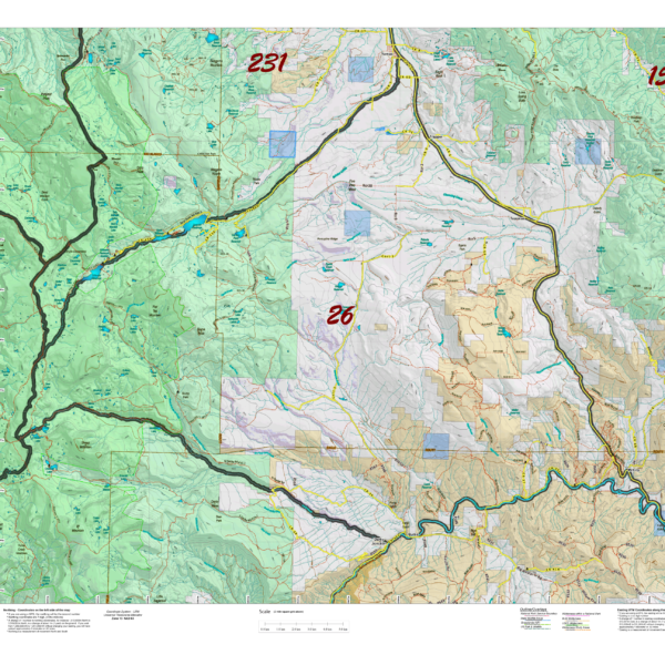
| Game Management Unit | GMU #1, GMU #2, GMU #3, GMU #4, GMU #5, GMU #6, GMU #7, GMU #8, GMU #9, GMU #10, GMU #11, GMU #12, GMU #13, GMU #14, GMU #15, GMU #16, GMU #17, GMU #18, GMU #19, GMU #20, GMU #21, GMU #22, GMU #23, GMU #24, GMU #25, GMU #26, GMU #27, GMU #28, GMU #29, GMU #30, GMU #31, GMU #32, GMU #33, GMU #34, GMU #35, GMU #36, GMU #37, GMU #38, GMU #39, GMU #40, GMU #41, GMU #42, GMU #43, GMU #44, GMU #45, GMU #46, GMU #47, GMU #48, GMU #49, GMU #50, GMU #51, GMU #52, GMU #53, GMU #54, GMU #55, GMU #56, GMU #57, GMU #58, GMU #59, GMU #60, GMU #61, GMU #62, GMU #63, GMU #64, GMU #65, GMU #66, GMU #67, GMU #68, GMU #69, GMU #70, GMU #71, GMU #72, GMU #73, GMU #74, GMU #75, GMU #76, GMU #77, GMU #78, GMU #79, GMU #80, GMU #81, GMU #82, GMU #83, GMU #84, GMU #85, GMU #86, GMU #118, GMU #123, GMU #131, GMU #161, GMU #171, GMU #181, GMU #191, GMU #201, GMU #211, GMU #214, GMU #231, GMU #301, GMU #371, GMU #391, GMU #411, GMU #421, GMU #441, GMU #444, GMU #461, GMU #471, GMU #481, GMU #500, GMU #501, GMU #511, GMU #512, GMU #521, GMU #551, GMU #561, GMU #581, GMU #591, GMU #681, GMU #691, GMU #711, GMU #741, GMU #751, GMU #771, GMU #851, GMU #861, None |
|---|
Reviews (0)
Only logged in customers who have purchased this product may leave a review.
Shipping & Delivery
Related products
CO 2 Map Combo Special! Elk and Land Ownership Maps are $19.95 each with the 2 map “Combo Pack”.
Now pay $19.95 each (2 maps) when you buy both the Land Ownership and Elk Concentration Maps for your Unit. Printed on our rugged fabric material, the 2 Map "Hunting Pack" - Land Ownership and Elk Concentration Maps - are the ideal field guide for your hunting group! Click Here to see the Statewide GMU Reference Map.
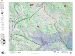
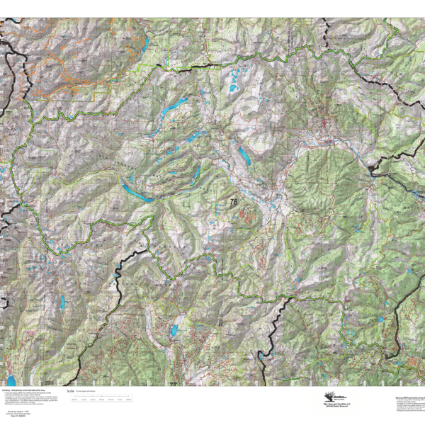
Colorado Elk Concentration Maps.
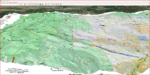
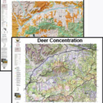
Elk Concentration Maps were invented by HuntData. These maps have been our best sellers over the past 25 years. This year, we updated the styles, enhancing boundaries, clarifying summer, winter, and resident herds, migration routes and adding 7.5-minute roads from the USGS Quad collection. The maps are printed on our rugged map fabric designed to last as long as your hunting memory.

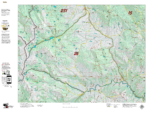
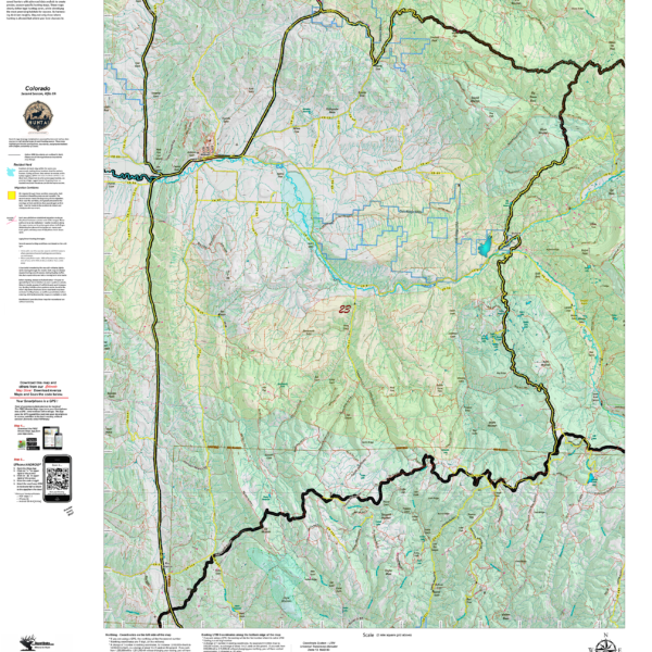
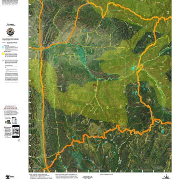
Colorado Land Ownership Unit Maps – Deer, Elk, Antelope
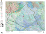
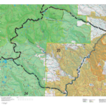
Our brand new Land Ownership Maps built with 2019 land ownership data from the BLM, State of Colorado and other Federal Agencies such as the National Forest. The maps display Public, Private, National Forest, BLM, State, CPW, and Federal Lands. All printed on our rugged fabric material designed to last as long as your hunting memories. Click on the small map to the left to see a large sample. Then scroll to the bottom to read more and order. Click Here to see the Statewide GMU Reference Map.
Colorado Land Ownership Unit Maps $19.95 – $29.95
Our Land Ownership Maps are built with updated land ownership data from the BLM, State of Colorado and other Federal Agencies such as the National Forest. The maps display Public, Private, National Forest, BLM, State, CPW, and Federal Lands. We transferred the roads and trails from the USGS 7.5-minute maps. A great map to help keep you on public ground. The maps are printed on tear-proof, water resistant paper or choose our rugged, long-lasting fabric.
HuntAI – Second Rifle Recommendations
Elk Concentration Maps were invented by HuntData. These maps have been our best sellers over the past 25 years. This year, we updated the styles, enhancing boundaries, clarifying summer, winter, and resident herds, migration routes and adding 7.5-minute roads from the USGS Quad collection. The maps are printed on our rugged map fabric designed to last as long as your hunting memory.
Reviews
There are no reviews yet.