
Save with CO Bighorn Sheep 3D and Printed Map Combo’s
Price range: $59.95 through $109.99
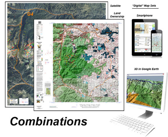
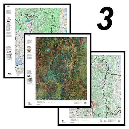
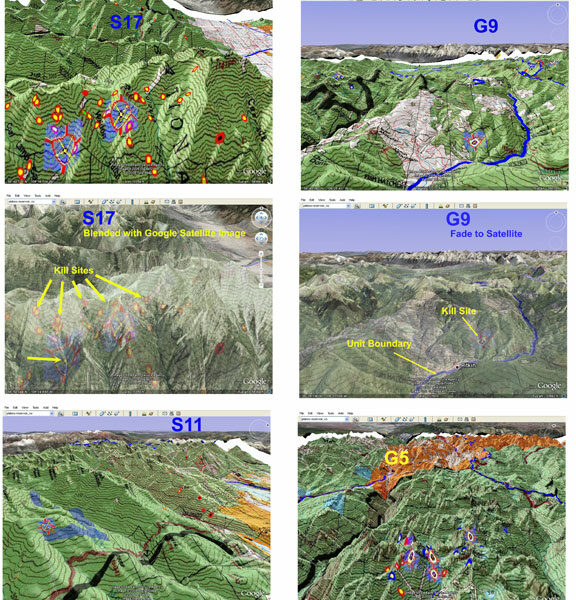
This combo includes one, two, or all three printed Land Ownership, Satellite, and Topo Maps combined with the 3D versions of the maps. The maps are printed on our rugged water and tear resistant fabric. The 3D images contain quick scan QR codes for loading into your Smartphone.
This combo includes 3 printed custom maps with roads and trails extracted from the USGS 7.5 minute Quad maps. The land ownership maps are built using current land ownership data from the BLM identifying private, BLM, National Forest, CPW and other public land parcels. The Land Ownership and Satellite maps have plotted kill sites and drainages with summer and winter concentrations. The kill sites are color coded by year. The Topo Map provides a traditional Topo view with unit boundaries and the shaded green vegetation.
The 3D maps can be opened in Google Earth. The Digital maps (3) are exact copies of the printed maps.
All of the maps are built from the bottom up ensuring accurate, current data. They are projected at 1:60,000, 1:100,000 or 1:120,000 scales depending on the size of the unit.
One additional feature, the printed maps are printed on our rugged tear and water-resistant cloth material. These maps will last as long as your memories!
This package will truly let you figure out where you CAN and SHOULD be hunting! “Where to Hunt” in one package.
| Weight | 3 oz |
|---|---|
| Bighorn Sheep 3D Maps | Unit S1, Unit S2, Unit S3, Unit S4, Unit S5, Unit S6, Unit S7, Unit S8, Unit S9, Unit S10, Unit S11, Unit S12, Unit S13, Unit S14, Unit S15, Unit S16, Unit S17, Unit S18, Unit S19, Unit S20, Unit S21, Unit S22, Unit S23, Unit S24, Unit S25, Unit S26, Unit S27, Unit S28, Unit S29, Unit S30, Unit S31, Unit S32, Unit S33, Unit S34, Unit S35, Unit S36, Unit S37, Unit S38, Unit S39, Unit S40, Unit S41, Unit S42, Unit S43, Unit S44, Unit S45, Unit S46, Unit S47, Unit S48, Unit S49, Unit S50, Unit S51, Unit S52, Unit S53, Unit S54, Unit S55, Unit S56, Unit S57, Unit S58, Unit S59, Unit S60, Unit S61, Unit S62, Unit S63, Unit S64, Unit S65, Unit S66, Unit S67, Unit S68, Unit S69, Unit S70, Unit S71, Unit S72, Unit S73, Unit S74 |
| Sheep Combinations | 3 Printed Maps, Land Ownership, Satellite, Topo (99.99), 3 Printed Maps, Land Ownership, Satellite, Topo, plus 3D Digital Images (109.99), 2 Printed Maps, Land Ownership and Satellite, plus 3D Digital Images (79.95), 2 Printed Maps, Satellite and Topo, plus 3D Digital Images (79.95), 2 Printed Maps, Land Ownership and Topo, plus 3D Digital Images (79.95), 2 Printed Maps, Land Ownership and Satellite (69.95), 2 Printed Maps, Land Ownership and Topo (59.95) |
Only logged in customers who have purchased this product may leave a review.
Related products
CO Bighorn Custom Unit Topographical Map
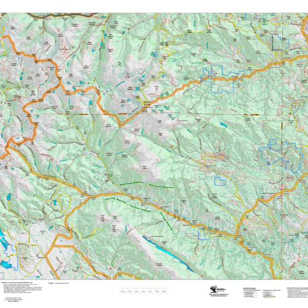
The Bighorn Sheep Topo map is a custom built Unit map at 1:60,000, 1:100,000, or 1:120,000 scales depending on the size of the unit. We layer Unit boundaries, public and private land outlines, elevation contours, add the familiar green vegetation shading, then add the roads and trails extracted from the new USGS Quad maps. Regardless of the map scale, it will have all of the roads and trails from the 7.5 minute Quads.
All of this information is printed on our rugged rip and water resistant fabric. This map will last as long as your hunting memories.
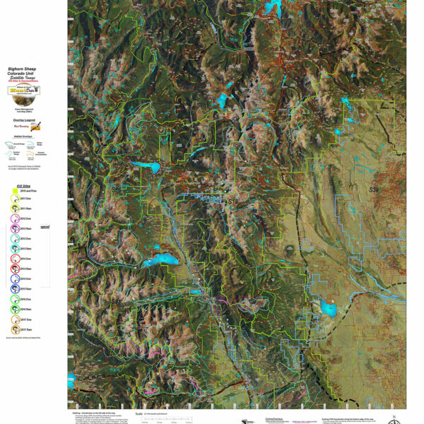
CO Bighorn Kill Sites and Concentrations on a Satellite Image.
A printed aerial photo of the entire unit with boundaries, historical kill sites plotted by year, summer and winter concentrations. Get a unique, one-of-a-kind perspective of your unit. We overlay roads and trails from the USGS 7.5 minute quad maps. Printed on our rugged fabric map material. The map will last as long as your memories.
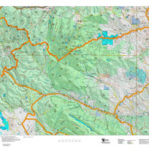
CO Bighorn Sheep Unit Land Ownership Map with Kill Sites and Concentrations
A vibrant bighorn sheep unit map with land ownership, kill drainages, kill sites color coded by year, summer and winter concentrations, and migration corridors. Our base land ownership maps vary from 1:60,000 to 1:120,000 depending on the unit size. All of the maps display the roads and trails layer extracted from the USGS 7.5 minute map series. The maps are printed on our rugged tear proof and water resistant fabric that will last as long as your hunting memories!
Reviews
There are no reviews yet.