


CO Moose Topographical Unit Map
Price range: $39.95 through $59.95
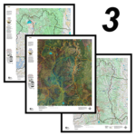
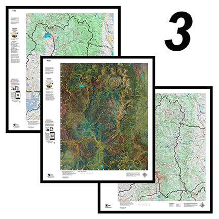
3 Colorado Moose Printed Maps - Land Ownership, Satellite, Topo - Save $30
Price range: $89.95 through $109.95
Colorado 3D Moose Map.
$39.95
View a map of your Moose unit in 3D on Google Earth! Click Here to see the Statewide GMU Reference Map.
Additional information
| Game Management Unit | Moose Unit 1, Moose Unit 4, Moose Unit 5, Moose Unit 6, Moose Unit 7, Moose Unit 8, Moose Unit 12, Moose Unit 14, Moose Unit 15, Moose Unit 16, Moose Unit 17, Moose Unit 18, Moose Unit 19, Moose Unit 20, Moose Unit 23, Moose Unit 24, Moose Unit 27, Moose Unit 28, Moose Unit 29, Moose Unit 36, Moose Unit 37, Moose Unit 38, Moose Unit 39, Moose Unit 41, Moose Unit 42, Moose Unit 44, Moose Unit 45, Moose Unit 46, Moose Unit 48, Moose Unit 49, Moose Unit 52, Moose Unit 55, Moose Unit 56, Moose Unit 65, Moose Unit 66, Moose Unit 67, Moose Unit 68, Moose Unit 74, Moose Unit 75, Moose Unit 76, Moose Unit 77, Moose Unit 79, Moose Unit 161, Moose Unit 171, Moose Unit 181, Moose Unit 191, Moose Unit 201, Moose Unit 361, Moose Unit 371, Moose Unit 411, Moose Unit 421, Moose Unit 481, Moose Unit 500, Moose Unit 501, Moose Unit 521, Moose Unit 551, Moose Unit 561, Moose Unit 681, Moose Unit 751, Weminuchie Wilderness |
|---|
Reviews (0)
Only logged in customers who have purchased this product may leave a review.
Shipping & Delivery
Related products

3 Colorado Moose Printed Maps – Land Ownership, Satellite, Topo – Save $30
This combo includes 3 printed custom maps with roads and trails extracted from the USGS 7.5 minute Quad maps.
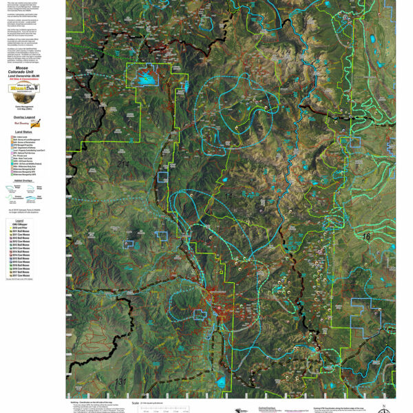
The land ownership maps are built using current land ownership data from the BLM identifying private, BLM, National Forest, CPW and other public land parcels. The Land Ownership and Satellite maps have plotted kill sites and drainages with summer and winter concentrations. The kill sites are color coded by year. The Topo Map provides a traditional Topo view with unit boundaries and the shaded green vegetation.
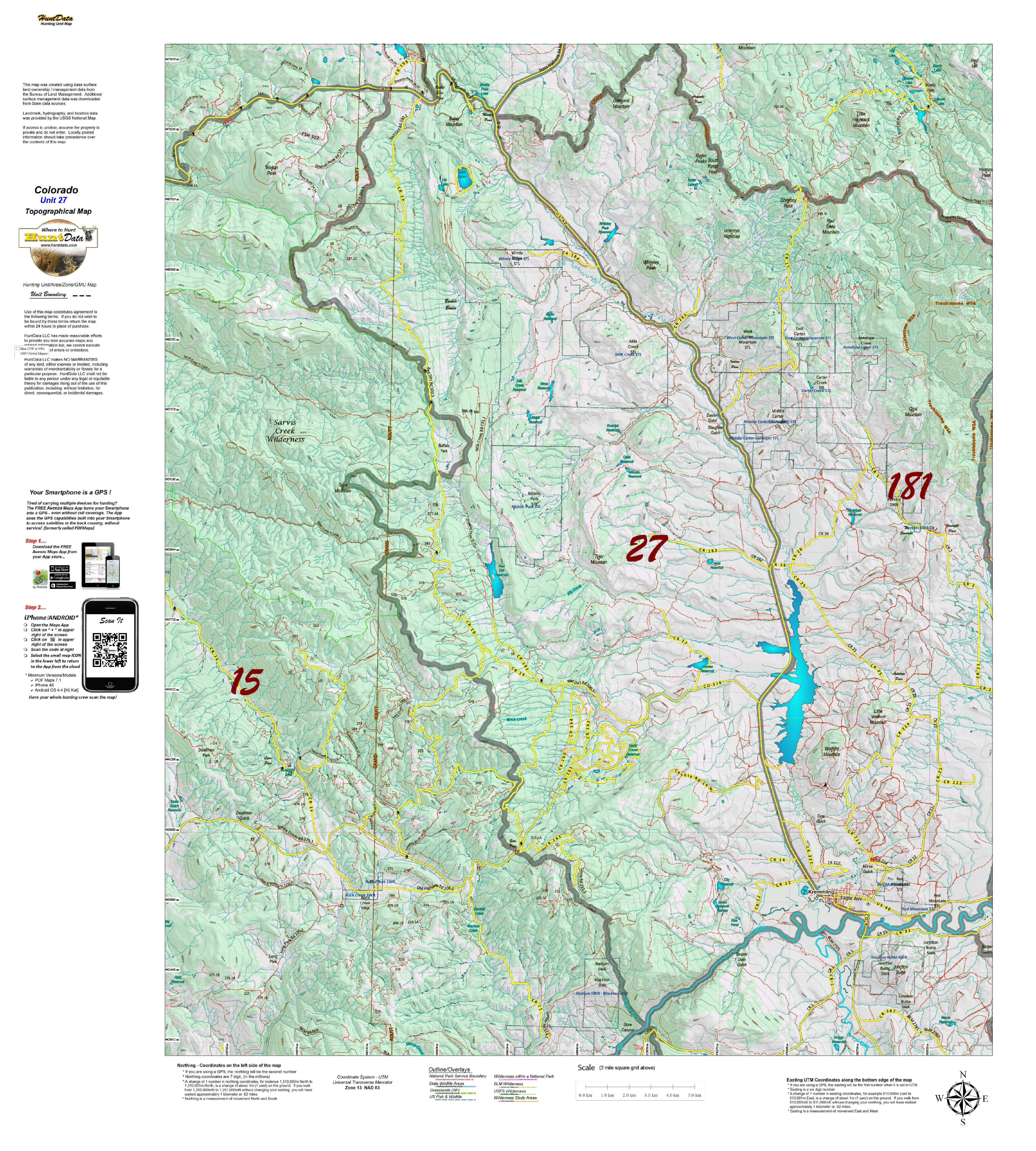
CO Moose Topographical Unit Map
Our Topo Maps are built from the ground up at 1:60,000, 1:100,000 and 1:120,000 scales adjusted based on the size of the unit. The maps provide a traditional Topographical Map view with National Forest and other Public Land boundaries. The map is printed on our popular tear and water resistant map fabric.
Colorado Moose Centerpoint Map
Have you zeroed in on a hunting spot? A Centerpoint Map is what you need! Give us coordinates of your centerpoint and we’ll build a 7.5 minute (1:24,000) map around the map stretching 4 miles in each direction (8 x 8 miles total). We will use the based maps from the USGS 7.5 minute Quad Topo or Satellite series, add unit boundaries and private land. You will end up with the most detailed map available. Type your coordinates in the box below and we’ll build the map. Please note the unit you are hunting in for our build reference. The map will be printed on our rugged tear and water resistant fabric. You will love this map.
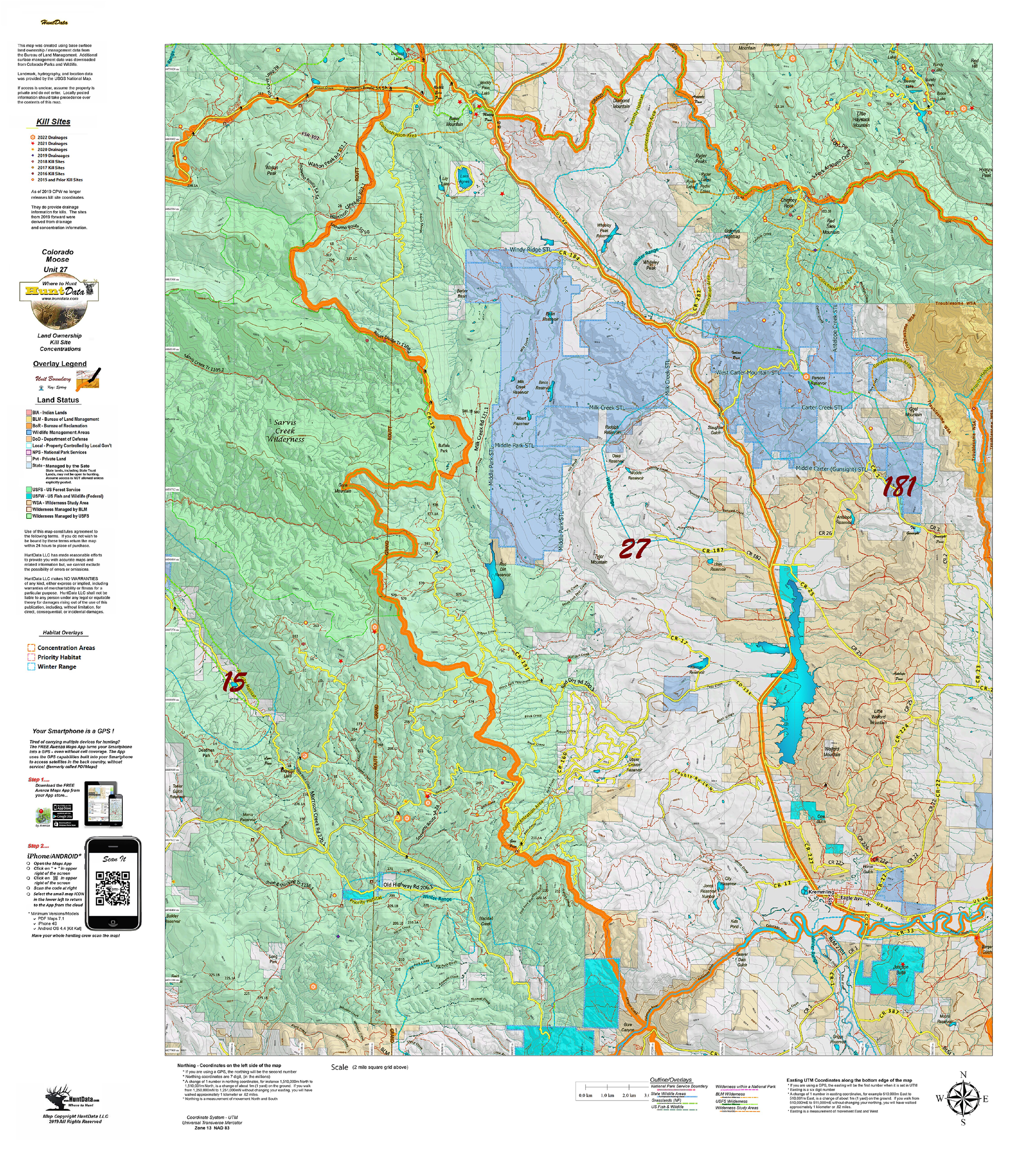
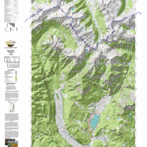
Colorado Moose Kill Sites and Concentrations on Land Ownership Map
A vibrant moose unit map with land ownership, kill drainages, kill sites color coded by year, summer and winter concentrations, and migration corridors. Our base land ownership maps vary from 1:60,000 to 1:120,000 depending on the unit size. All of the maps display the roads and trails layer extracted from the USGS 7.5 minute map series. The maps are printed on our rugged tear proof and water resistant fabric that will last as long as your hunting memories!
Reviews
There are no reviews yet.