


Maps designed using the experience and analysis of seasoned hunters. The maps contain recommendations for archery, muzzleloading, and rifle elk seasons in Colorado. The maps highlight areas where the odds of success are higher during these seasons.
Colorado Land Ownership Unit Maps $19.95 – $29.95
Our Land Ownership Maps are built with updated land ownership data from the BLM, State of Colorado and other Federal Agencies such as the National Forest. The maps display Public, Private, National Forest, BLM, State, CPW, and Federal Lands. We transferred the roads and trails from the USGS 7.5-minute maps. A great map to help keep you on public ground. The maps are printed on tear-proof, water resistant paper or choose our rugged, long-lasting fabric.
Select options
This product has multiple variants. The options may be chosen on the product page
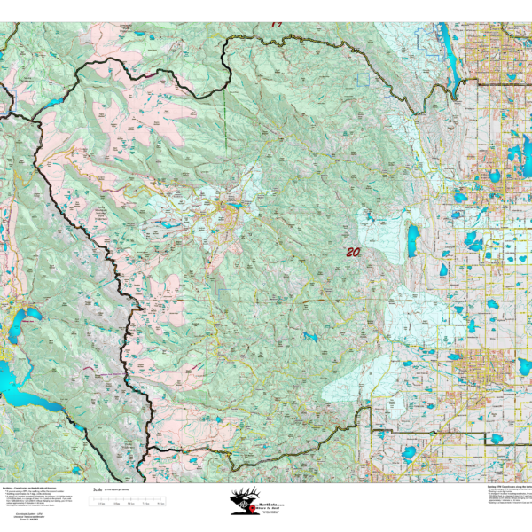
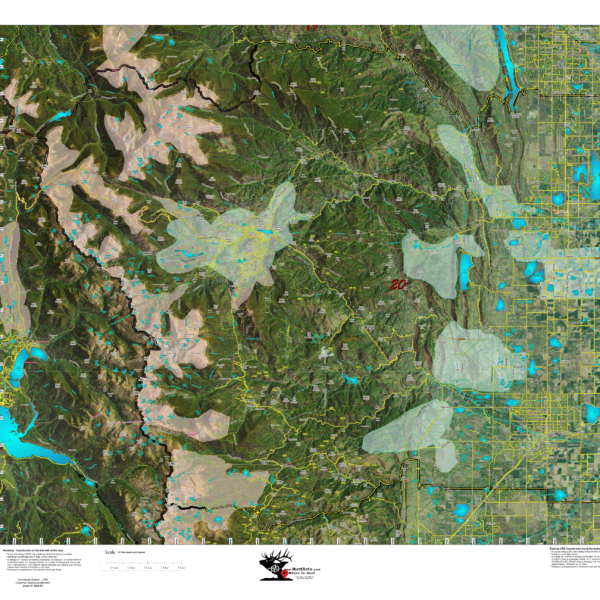
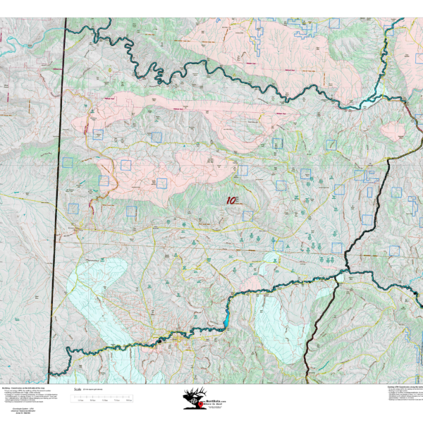
HuntAI – 3rd, 4th, and Late Season Recommendations
Elk Concentration Maps were invented by HuntData. These maps have been our best sellers over the past 25 years. This year, we updated the styles, enhancing boundaries, clarifying summer, winter, and resident herds, migration routes and adding 7.5-minute roads from the USGS Quad collection. The maps are printed on our rugged map fabric designed to last as long as your hunting memory.
Select options
This product has multiple variants. The options may be chosen on the product page
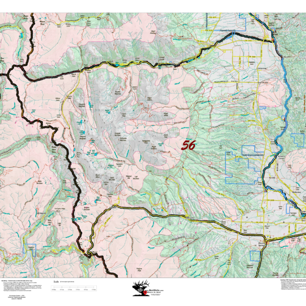
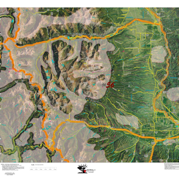
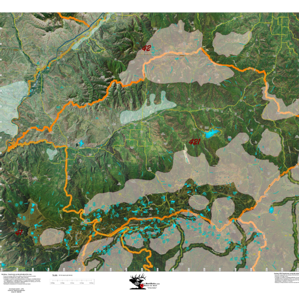
HuntAI – Archery Recommendations
Elk Concentration Maps were invented by HuntData. These maps have been our best sellers over the past 25 years. This year, we updated the styles, enhancing boundaries, clarifying summer, winter, and resident herds, migration routes and adding 7.5-minute roads from the USGS Quad collection. The maps are printed on our rugged map fabric designed to last as long as your hunting memory.
Select options
This product has multiple variants. The options may be chosen on the product page
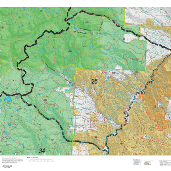
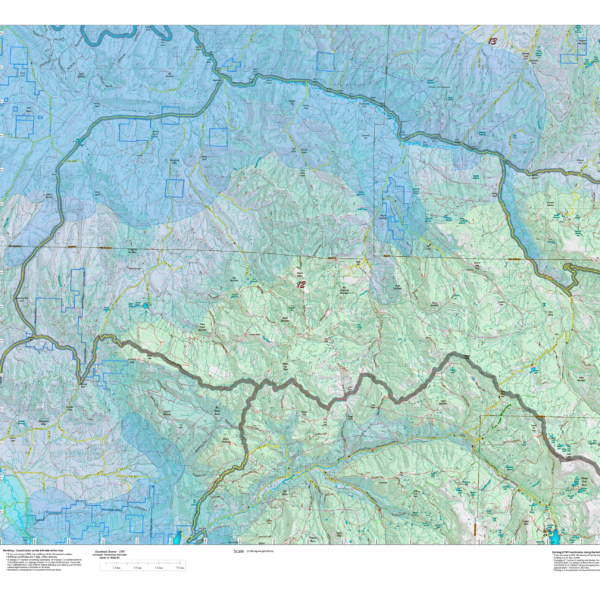
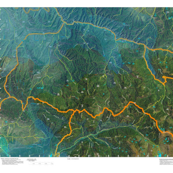
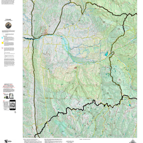
HuntAI – First Rifle Recommendations
Elk Concentration Maps were invented by HuntData. These maps have been our best sellers over the past 25 years. This year, we updated the styles, enhancing boundaries, clarifying summer, winter, and resident herds, migration routes and adding 7.5-minute roads from the USGS Quad collection. The maps are printed on our rugged map fabric designed to last as long as your hunting memory.
Select options
This product has multiple variants. The options may be chosen on the product page
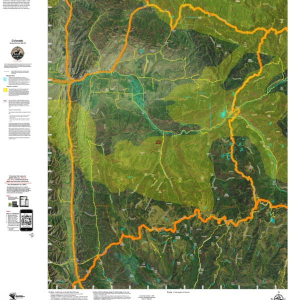
HuntAI – Muzzleloading Recommendations
Elk Concentration Maps were invented by HuntData. These maps have been our best sellers over the past 25 years. This year, we updated the styles, enhancing boundaries, clarifying summer, winter, and resident herds, migration routes and adding 7.5-minute roads from the USGS Quad collection. The maps are printed on our rugged map fabric designed to last as long as your hunting memory.
Select options
This product has multiple variants. The options may be chosen on the product page
HuntAI – Second Rifle Recommendations
Elk Concentration Maps were invented by HuntData. These maps have been our best sellers over the past 25 years. This year, we updated the styles, enhancing boundaries, clarifying summer, winter, and resident herds, migration routes and adding 7.5-minute roads from the USGS Quad collection. The maps are printed on our rugged map fabric designed to last as long as your hunting memory.
Select options
This product has multiple variants. The options may be chosen on the product page