


Digital Maps – Wyoming State Map Set.
A first of its kind. The Statewide Wyoming Map set consists of over 1,100 maps. This includes 3 maps for every Antelope Unit. A Topo map with boundaries, a Land Ownership Map from the BLM, and a first of its kind - a habitat map showing summer range, winter range, and migration routs. View these maps on your desktop or go mobile and load them to your iPhone, iPad, or DROID. A must-have for serious hunters.
Select options
This product has multiple variants. The options may be chosen on the product page
Wyoming Moose Hybrid Map
Select options
This product has multiple variants. The options may be chosen on the product page
Wyoming White Tail Deer Maps.
Select options
This product has multiple variants. The options may be chosen on the product page
Wyoming Mtn Goat Hybrid.
A great map for a once-in-a-life-time hunt. Land Ownership with an overlay of 7.5 Minute Roads and Trails with summer, year-round, and winter concentration areas.
Select options
This product has multiple variants. The options may be chosen on the product page
Wyoming Black Bear Land Ownership.
Select options
This product has multiple variants. The options may be chosen on the product page
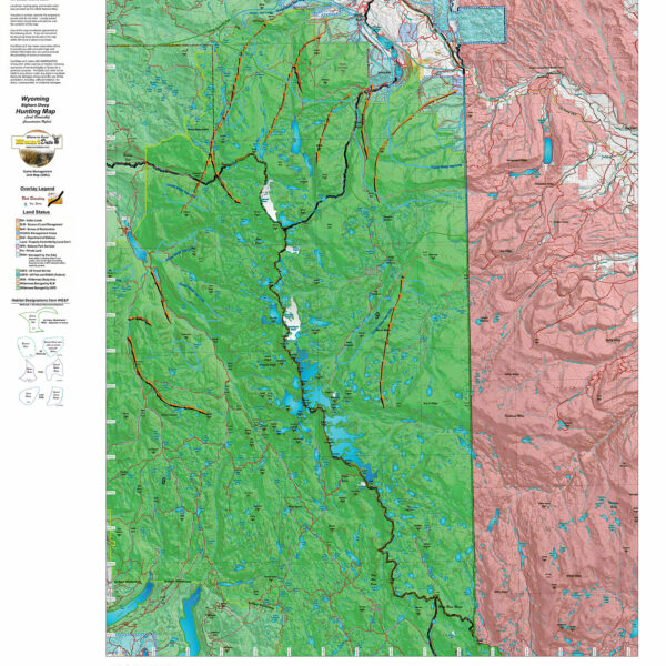
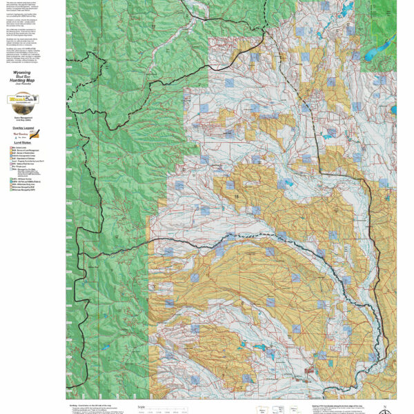
Wy Bighorn Sheep Hybrid Map, Land Ownership and Habitat
Our Hybrid Maps are built with land ownership data then we project Summer, Fall, and Winter Concentration data to create a map showing you not only where you CAN hunt, but where you SHOULD hunt as well! Click on the small map at left to see a larger sample then Scroll to the bottom of the map to order then move to the bottom right to Add To Cart.We also add the USGS roads and trails from their 7.5minute Quad Maps. We use 5 different software programs to handle the complexity and publication of these maps. The Hybrid maps are printed on our rugged map fabric to create a map that will last as long as your memories!
Select options
This product has multiple variants. The options may be chosen on the product page
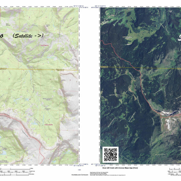
Wyoming Custom 7.5 minute Centerpoint Map.
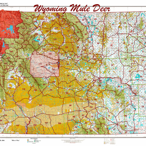
Printed Wyoming Statewide Mule Deer Unit Map.
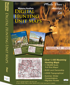
Wyoming Statewide Digital Map Collection.
A first of its kind. The Statewide Wyoming Map set consists of over 1,100 maps. This includes 3 maps for every Deer Unit. A Topo map with boundaries, a Land Ownership Map from the BLM, and a first of its kind - a habitat map showing summer range, winter range, and migration routs. View these maps on your desktop or go mobile and load them to your iPhone, iPad, or DROID. A must-have for serious hunters.
Select options
This product has multiple variants. The options may be chosen on the product page
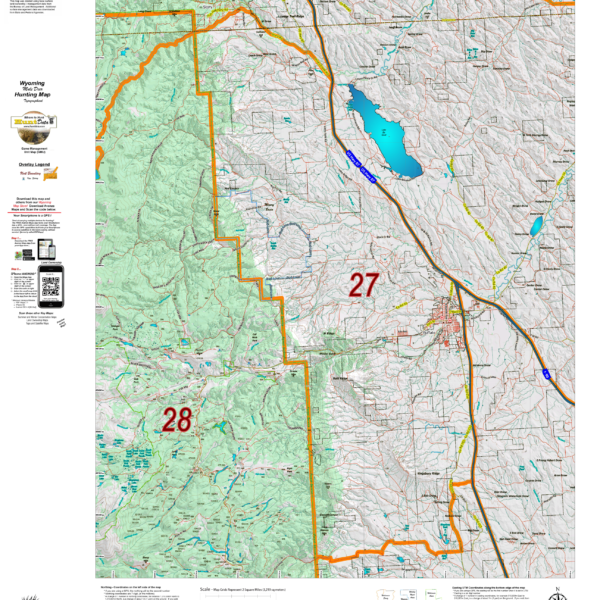
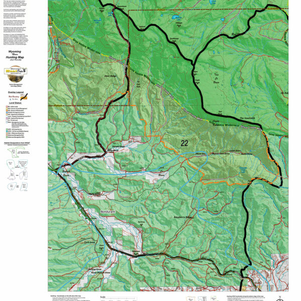
Wyoming Mule Deer Topograhical Maps.
We rebuilt the entire Topo line. We've updated the roads and trails USGS 7.5 minute Quad series. US Forest Boundaries and State Lands are newly updated and highlights. A great traditional Topo map with enhancements. Click Here to see the Wyoming Deer GMU Reference Map.
Select options
This product has multiple variants. The options may be chosen on the product page
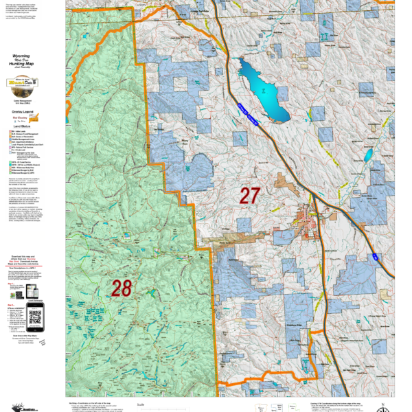
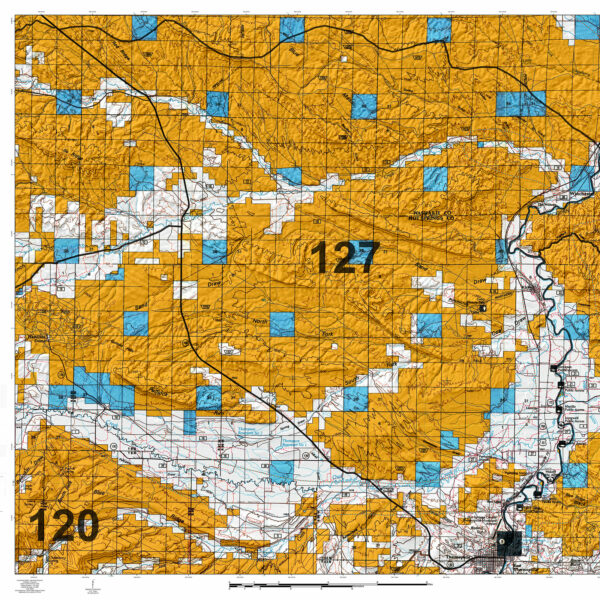
Wyoming Mule Deer Land Ownership Maps.
We took new land ownership data and built these maps from the bottom up. The maps include the USGS roads and trails from their 7.5min Quad Series. The maps are printed on our new rugged map fabric. A great tool to find out where you can hunt. Click Here to see the Wyoming Deer GMU Reference Map.
Select options
This product has multiple variants. The options may be chosen on the product page
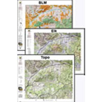
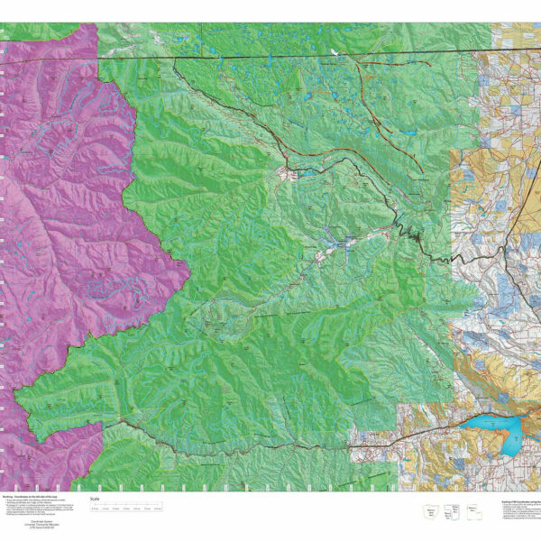
Wyoming Mule Deer, 3 Map Special! Save $30 with a Land Ownership, Habitat, and Topo Hat Trick.
A combination of 3 printed maps, Land Ownership, Habitat and Topo. All 3 have updated land ownership, roads and trails from the USGS 7.5 minute quad maps. The Land Ownership and Habitat Maps are printed on our rugged map fabric. The Topo is printed on our tough tear and water resistant paper. This pack shows you where you CAN and where you SHOULD hunt. Where to Hunt in one package.
Select options
This product has multiple variants. The options may be chosen on the product page