


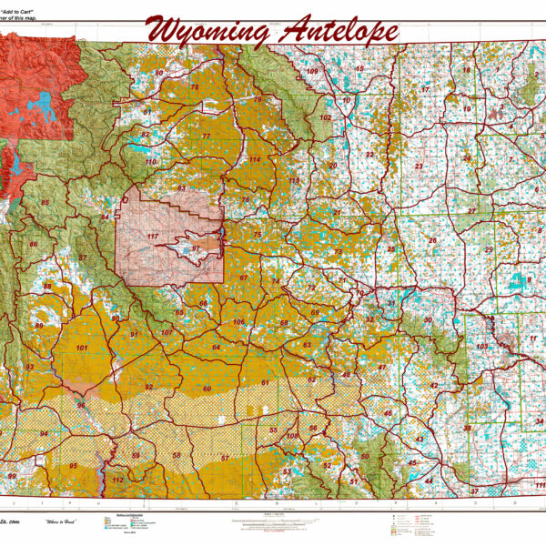
Wyoming Statewide Antelope Unit Map
Wyoming Statewide Digital Map Collection
HuntData produces the only map of this type. The 1:500,000 maps display land ownership in rich colors with antelope unit boundary overlays for the whole State. Click on the map for a larger image.
Select options
This product has multiple variants. The options may be chosen on the product page
Wyoming Statewide Digital Map Collection.
A first of its kind. The Statewide Wyoming Map set consists of over 1,100 maps. This includes 3 maps for every Deer Unit. A Topo map with boundaries, a Land Ownership Map from the BLM, and a first of its kind - a habitat map showing summer range, winter range, and migration routs. View these maps on your desktop or go mobile and load them to your iPhone, iPad, or DROID. A must-have for serious hunters.
Select options
This product has multiple variants. The options may be chosen on the product page

Wyoming Statewide Digital Map Collection.
A first of its kind. The Statewide Wyoming Map set consists of over 1,100 maps. This includes 3 maps for every elk Unit. A Topo map with boundaries, a Land Ownership Map from the BLM, and a first of its kind - a habitat map showing summer range, winter range, and migration routes. View these maps on your desktop or go mobile and load them to your iPhone, iPad, or DROID. A must-have for serious hunters.
Select options
This product has multiple variants. The options may be chosen on the product page
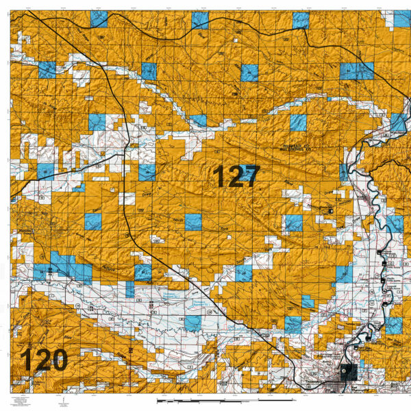
Wyoming White Tail Deer Maps.
Select options
This product has multiple variants. The options may be chosen on the product page