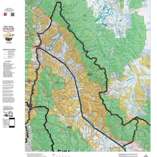
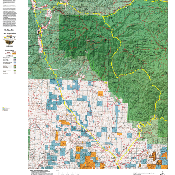
ID Antelope Land Ownership.
The Land Ownership Maps are built using land ownership data from USGS, National Forest and the State. We add current location data, streams, lakes, roads and trails from the USGS 7.5 minute Quad Map data set then print it on our rugged map fabric to create the best map in the industry. Click on the small map at left to see a larger sample. Scroll to the bottom of the map to order then move to the bottom right to Add To Cart.
Select options
This product has multiple variants. The options may be chosen on the product page

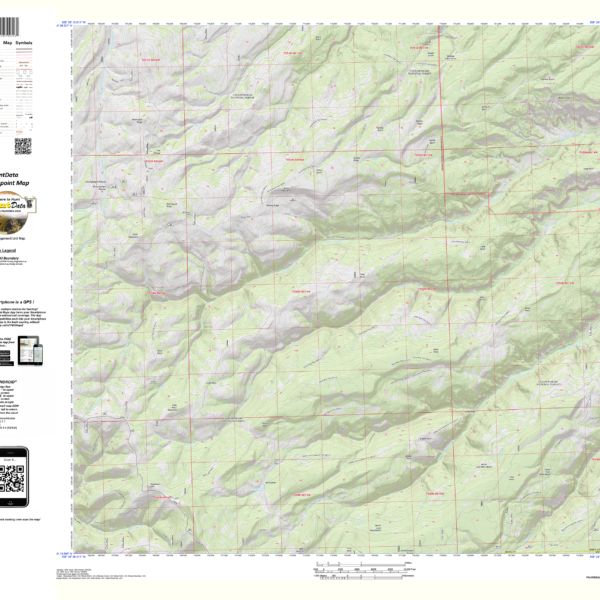
New Mexico 7.5 Minute Centerpoint – the most detailed map available
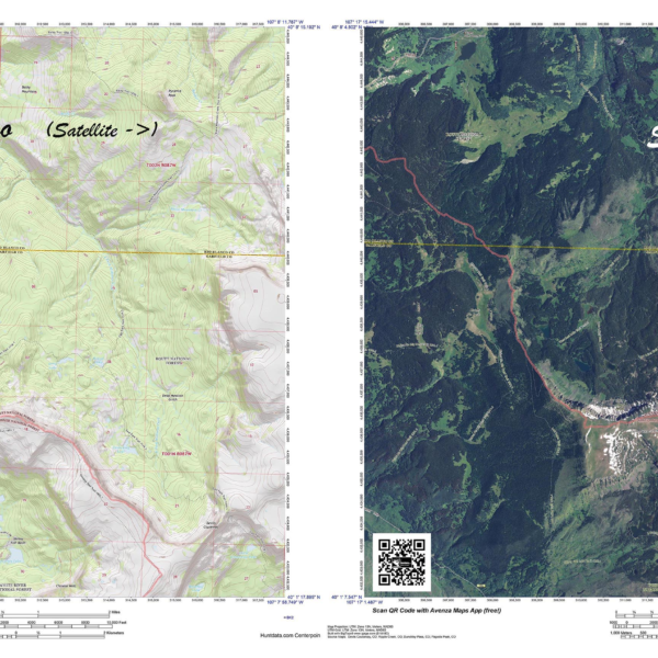
Have you zeroed in on a hunting spot? A Centerpoint Map is what you need! Give us coordinates of your centerpoint and we’ll build a 7.5 minute (1:24,000) Have you zeroed in on a hunting spot? A Centerpoint Map is what you need! Give us coordinates of your centerpoint and we’ll build a 7.5 minute (1:24,000) map around the map stretching 4 miles in each direction (8 x 8 miles total). We will use the based maps from the USGS 7.5 minute Quad Topo or Satellite series, add unit boundaries and private land. You will end up with the most detailed map available. Type your coordinates in the box below and we’ll build the map. Please note the unit you are hunting in for our build reference. The map will be printed on our rugged tear and water resistant fabric. You will love this map.
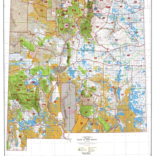
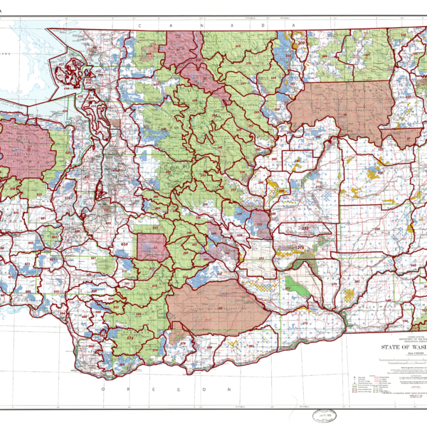
New Mexico Statewide Unit Map.
New Mexico Land Ownership Unit Map.
Land Ownership maps depicting National Forest, Private, State, BLM, and other public lands. All printed on our rugged Dura-map fabric.
Select options
This product has multiple variants. The options may be chosen on the product page
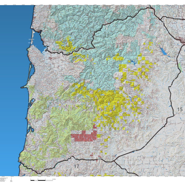
Oregon Unit Land Ownership Maps.
1:100,000 scale Unit Maps for Oregon. In addition to unit boundaries, the maps display National Forest, State, Private, USFW and Federal Lands.
Select options
This product has multiple variants. The options may be chosen on the product page
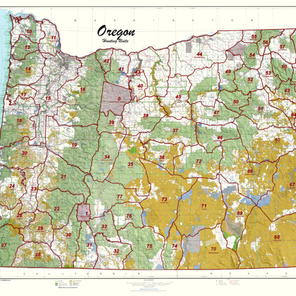
Oregon Statewide Unit Map.
MT Centerpoint Coordinates.
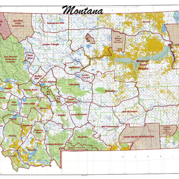
Mt. State Unit Map.
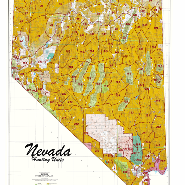
Nevada Statewide Unit Map
Nevada Centerpoint – the most detailed map available
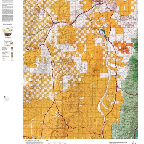
Nevada Land Ownership Unit Map
Base 1:100,000 maps displaying land status including National Forest, Private, State, BLM, and Wilderness Areas printed on our rugged fabric.
Select options
This product has multiple variants. The options may be chosen on the product page