Wyoming Printed Statewide Elk
Wyoming Mule Deer Land Ownership and Concentrations combined into one Hybrid map
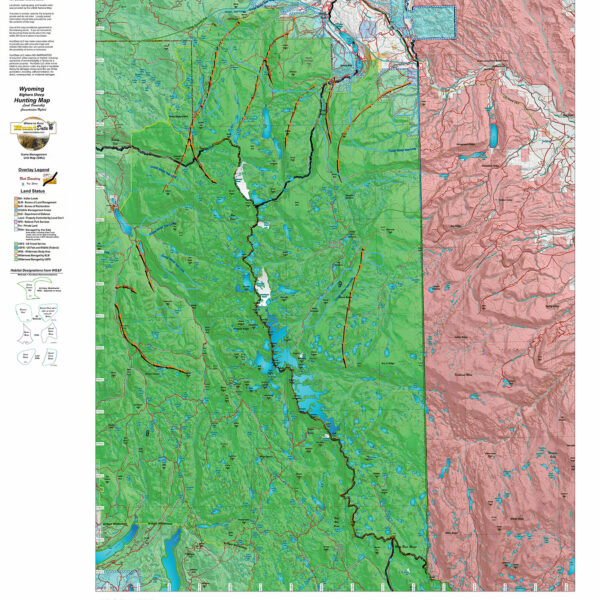
Over the years this has been our #1 requested map. This year, we used 5 different software processes to create the Wyoming Deer Hybrid Map. This map is built on our NEW Land Ownership Maps. We then overlay a 7.5 minute (Quads) road layer from the USGS, add National Forest Roads, add lakes and streams from the USGS and then add the Wyoming Parks and Wildlife summer, winter, and resident herd, migration routes and corridors for deer. This map has it all. Its all printed on our rugged map fabric. The fabric has a translucency that brings the colors and information to life! This is truly the most comprehensive map we’ve produced in the past 25 years. Click on the small map at left to see a larger sample. Then, scroll to the bottom to order. Click Here to see the Wyoming Deer GMU Reference Map.
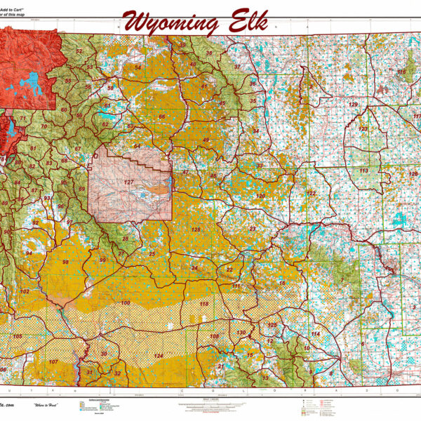
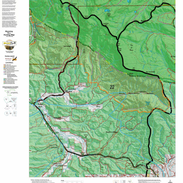
Will you be hunting Elk? Be sure to checkout our NEW! Wyoming Elk Land Ownership and Concentrations combined into one Hybrid map.
Will you be hunting Antelope? Be sure to checkout our NEW! Wyoming Antelope Land Ownership and Concentrations combined into one Hybrid map.
Select options
This product has multiple variants. The options may be chosen on the product page
Wy Bighorn Sheep Hybrid Map, Land Ownership and Habitat
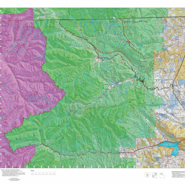
Our Hybrid Maps are built with land ownership data then we project Summer, Fall, and Winter Concentration data to create a map showing you not only where you CAN hunt, but where you SHOULD hunt as well! Click on the small map at left to see a larger sample then Scroll to the bottom of the map to order then move to the bottom right to Add To Cart.We also add the USGS roads and trails from their 7.5minute Quad Maps. We use 5 different software programs to handle the complexity and publication of these maps. The Hybrid maps are printed on our rugged map fabric to create a map that will last as long as your memories!
Select options
This product has multiple variants. The options may be chosen on the product page
Wyoming Mtn Goat Hybrid.
A great map for a once-in-a-life-time hunt. Land Ownership with an overlay of 7.5 Minute Roads and Trails with summer, year-round, and winter concentration areas.
Select options
This product has multiple variants. The options may be chosen on the product page
Wyoming Moose Hybrid Map
Select options
This product has multiple variants. The options may be chosen on the product page
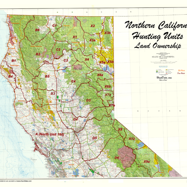
Northern California Zone Map.
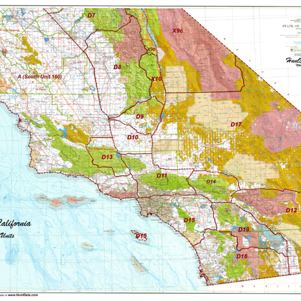
Southern California Zone Map.
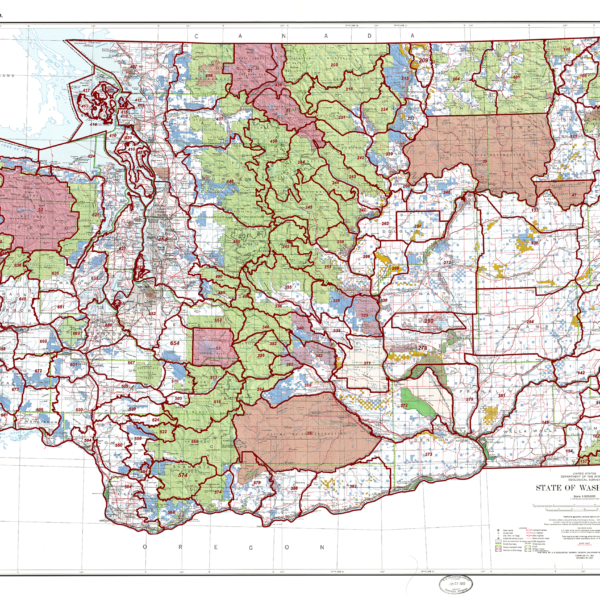
Washington State Unit Map
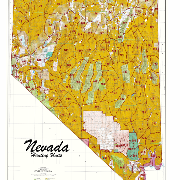
Nevada Statewide Unit Map
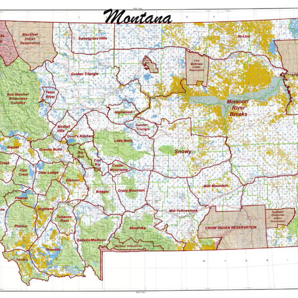
Mt. State Unit Map.
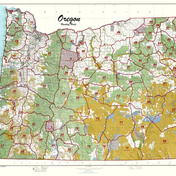
Oregon Statewide Unit Map.