


Colorado Topographical Maps 19.95 to 29.95
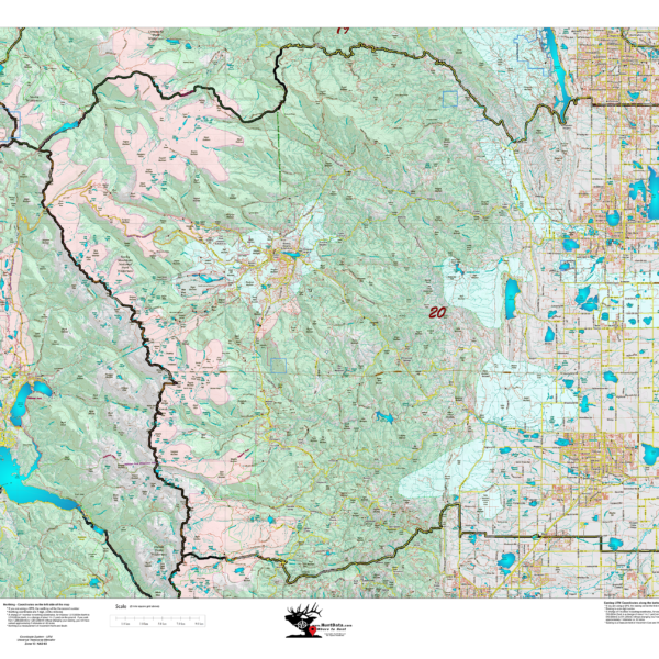
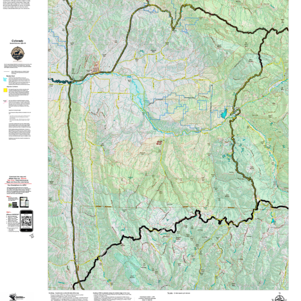
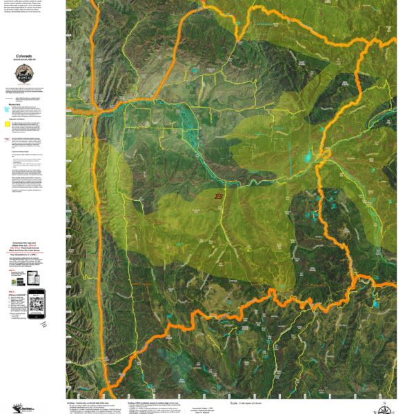
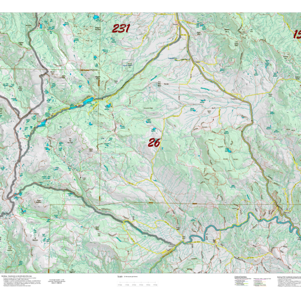
Out Topo maps are unique. We scale the map to ensure the entire unit is included then, generate the topo data including the roads and trails from the USGS 7.5 minute Quad series. The result is the most detailed roads and trails available for your unit.
Select options
This product has multiple variants. The options may be chosen on the product page
HuntAI – 3rd, 4th, and Late Season Recommendations
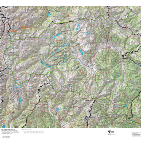
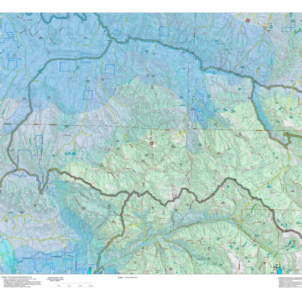
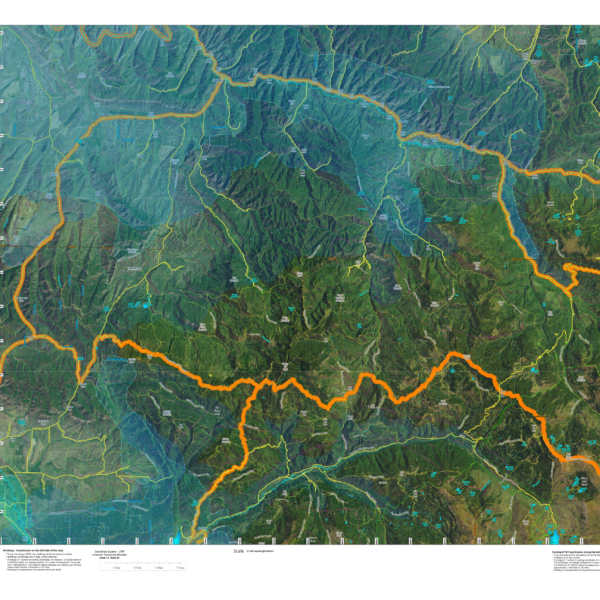
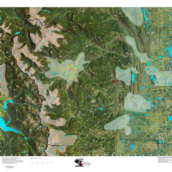
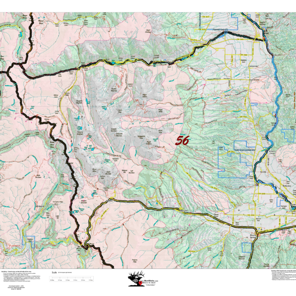
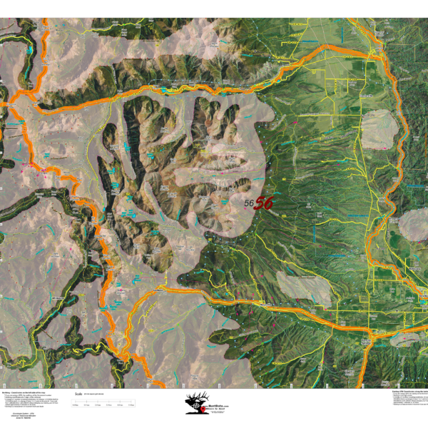
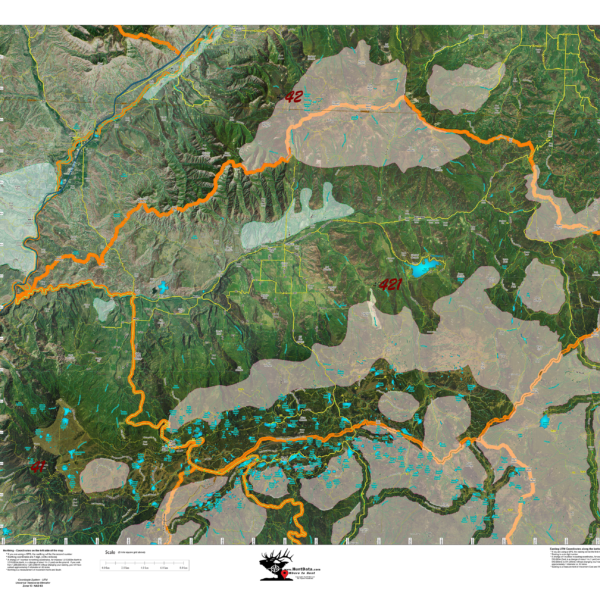
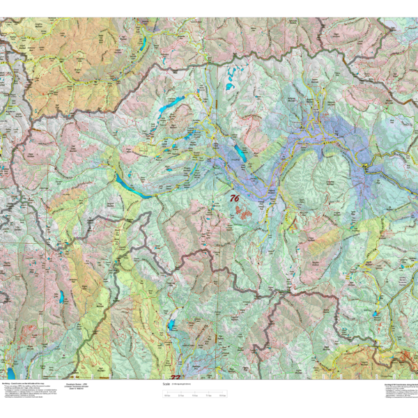
Elk Concentration Maps were invented by HuntData. These maps have been our best sellers over the past 25 years. This year, we updated the styles, enhancing boundaries, clarifying summer, winter, and resident herds, migration routes and adding 7.5-minute roads from the USGS Quad collection. The maps are printed on our rugged map fabric designed to last as long as your hunting memory.
Select options
This product has multiple variants. The options may be chosen on the product page
HuntAI – Archery Recommendations
Elk Concentration Maps were invented by HuntData. These maps have been our best sellers over the past 25 years. This year, we updated the styles, enhancing boundaries, clarifying summer, winter, and resident herds, migration routes and adding 7.5-minute roads from the USGS Quad collection. The maps are printed on our rugged map fabric designed to last as long as your hunting memory.
Select options
This product has multiple variants. The options may be chosen on the product page
HuntAI – First Rifle Recommendations
Elk Concentration Maps were invented by HuntData. These maps have been our best sellers over the past 25 years. This year, we updated the styles, enhancing boundaries, clarifying summer, winter, and resident herds, migration routes and adding 7.5-minute roads from the USGS Quad collection. The maps are printed on our rugged map fabric designed to last as long as your hunting memory.
Select options
This product has multiple variants. The options may be chosen on the product page
HuntAI – Muzzleloading Recommendations
Elk Concentration Maps were invented by HuntData. These maps have been our best sellers over the past 25 years. This year, we updated the styles, enhancing boundaries, clarifying summer, winter, and resident herds, migration routes and adding 7.5-minute roads from the USGS Quad collection. The maps are printed on our rugged map fabric designed to last as long as your hunting memory.
Select options
This product has multiple variants. The options may be chosen on the product page
HuntAI – Second Rifle Recommendations
Elk Concentration Maps were invented by HuntData. These maps have been our best sellers over the past 25 years. This year, we updated the styles, enhancing boundaries, clarifying summer, winter, and resident herds, migration routes and adding 7.5-minute roads from the USGS Quad collection. The maps are printed on our rugged map fabric designed to last as long as your hunting memory.
Select options
This product has multiple variants. The options may be chosen on the product page
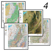
The Guide Pack – 4 Maps, Save $40 Elk Concentration, Land Ownership, Topo, Satellite Elk Concentration
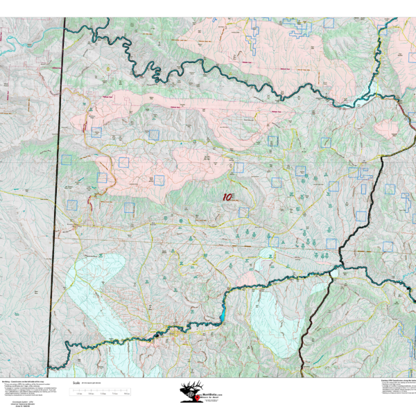
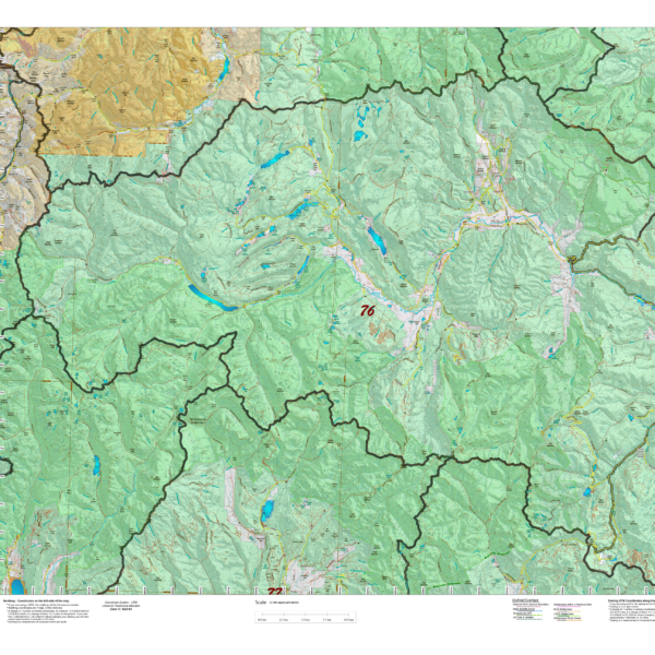
Land Ownership, Elk Concentration, and Topo Map. PLUS, the most unique map we've ever created, the Satellite Elk Concentration Map. The Land Ownership, Elk Concentration Maps and Satellite Maps are printed on our rugged fabric material, the Topo is more compact and printed on our water and tear-resistant paper. The Guide Pack is ideal for your hunting group!
Select options
This product has multiple variants. The options may be chosen on the product page
Two Sided, Elk Concentration and Land Ownership combined!
Two maps in one! Elk Concentrations on the front (image at left), and Land Ownership on the back (click on the other image). Both of these maps are on the same map. Zoom in, check out the samples. $19.95 while supplies last for select units only!
Select options
This product has multiple variants. The options may be chosen on the product page