


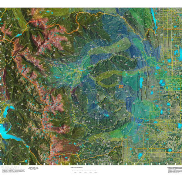
CO Hybrid Satellite Images with Elk Concentrations.
An enhanced satellite images with roads and trails fron the USGS 7.5 minute Quad maps and Elk Summer and Winter Concentration Areas.
Select options
This product has multiple variants. The options may be chosen on the product page
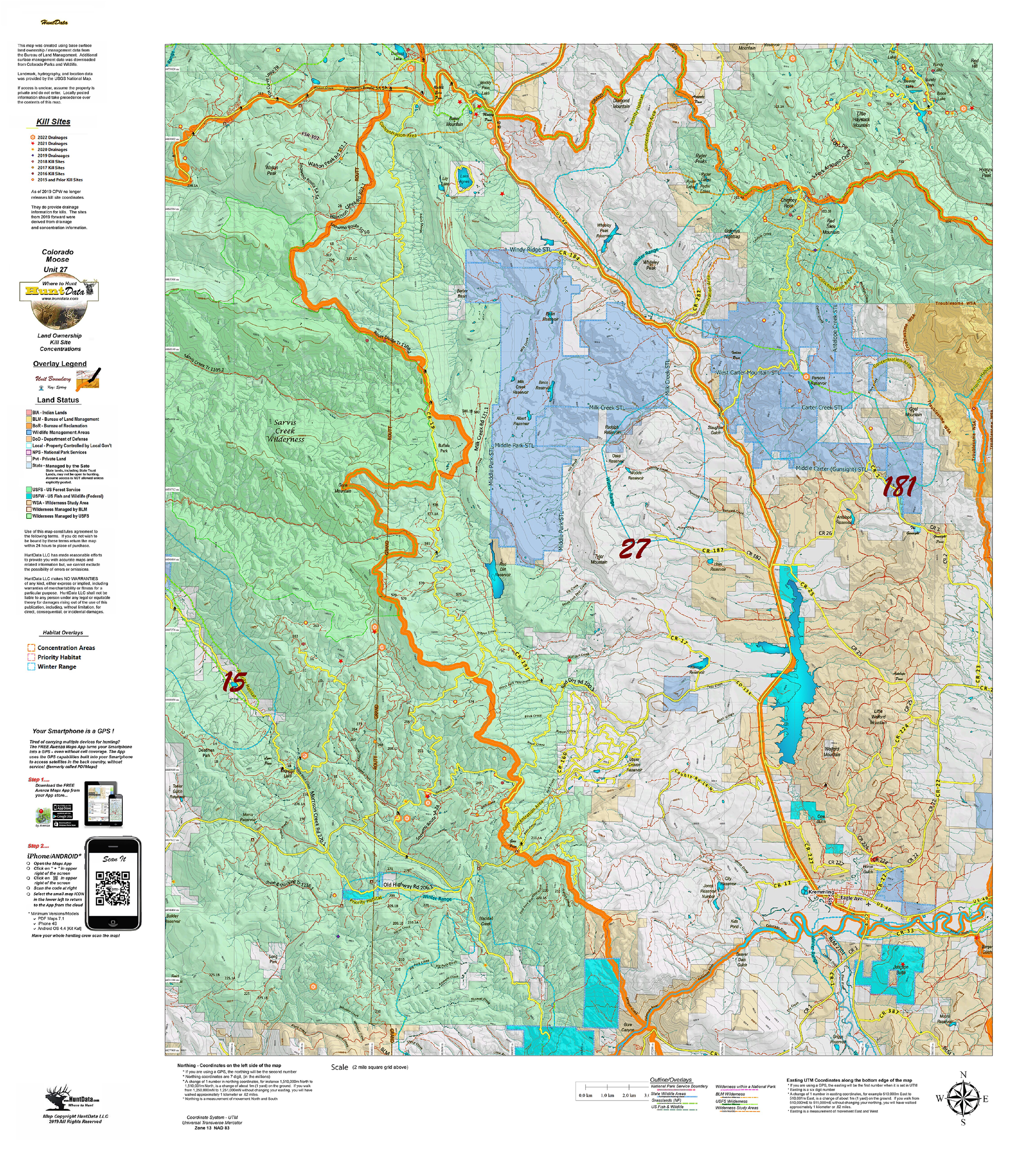
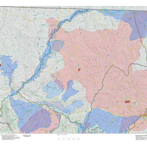
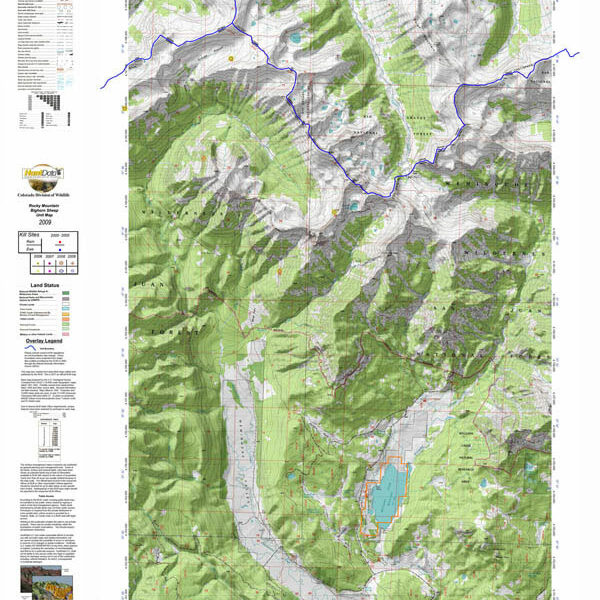
Colorado Moose Kill Sites and Concentrations on Land Ownership Map
A vibrant moose unit map with land ownership, kill drainages, kill sites color coded by year, summer and winter concentrations, and migration corridors. Our base land ownership maps vary from 1:60,000 to 1:120,000 depending on the unit size. All of the maps display the roads and trails layer extracted from the USGS 7.5 minute map series. The maps are printed on our rugged tear proof and water resistant fabric that will last as long as your hunting memories!
Select options
This product has multiple variants. The options may be chosen on the product page
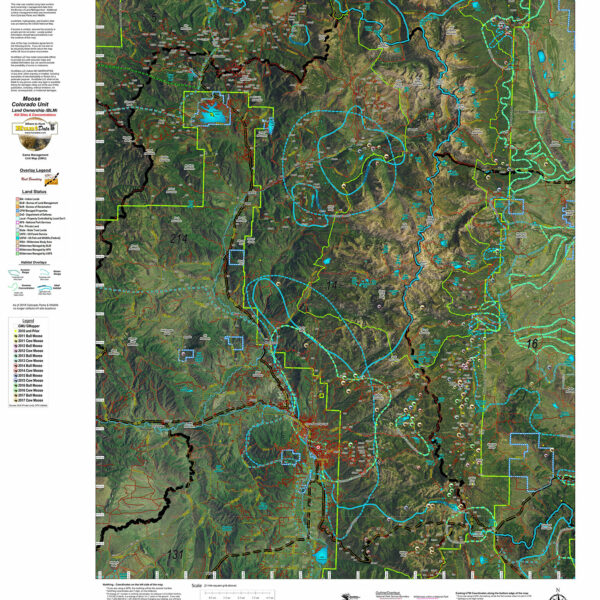
Colorado Moose Kill Sites and Concentrations on Satellite Map.
Custom Satellite Images with plotted kill sites color coded by year. Includes unit boundaries, roads and trails from the USGS 7.5 minute maps.
Select options
This product has multiple variants. The options may be chosen on the product page
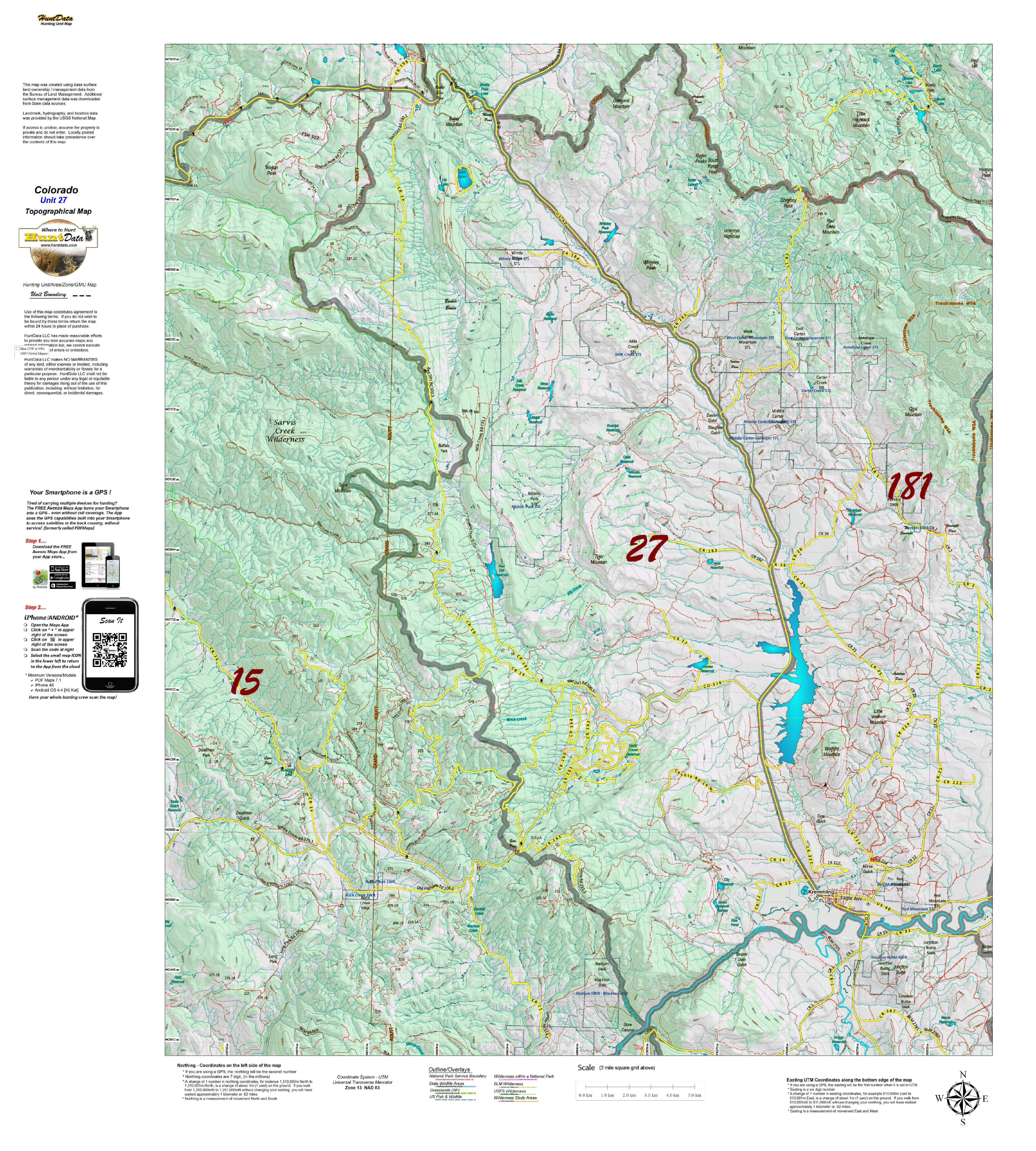
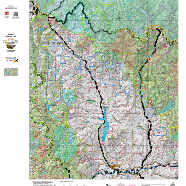
CO Moose Topographical Unit Map
Our Topo Maps are built from the ground up at 1:60,000, 1:100,000 and 1:120,000 scales adjusted based on the size of the unit. The maps provide a traditional Topographical Map view with National Forest and other Public Land boundaries. The map is printed on our popular tear and water resistant map fabric.
Select options
This product has multiple variants. The options may be chosen on the product page
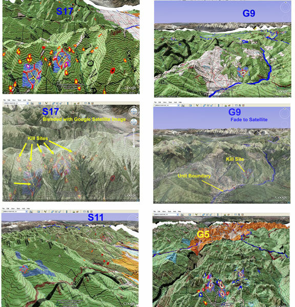
Colorado 3D Moose Map.
View a map of your Moose unit in 3D on Google Earth! Click Here to see the Statewide GMU Reference Map.
Select options
This product has multiple variants. The options may be chosen on the product page
Custom Antelope Concentration Maps
Antelop Concentration Maps were invented by HuntData. These maps have been our best sellers over the past 25 years. This year, we updated the styles, enhancing boundaries, clarifying summer, winter, and resident herds, migration routes and adding 7.5 minute roads from the USGS Quad collection. Click on the small map at left to see a larger sample. Then, scroll to the bottom to read more and order. This map will help put you in the right place for success! Its printed on our rugged map fabric designed to last as long as your hunting memory.
Select options
This product has multiple variants. The options may be chosen on the product page
Colorado Bear Concentration Map.
Newly designed base Topo Map with enhanced Summer and Fall Bear Concentration Overlays. Also with roads and trails from the USGS 7.5 minute quads.
Select options
This product has multiple variants. The options may be chosen on the product page
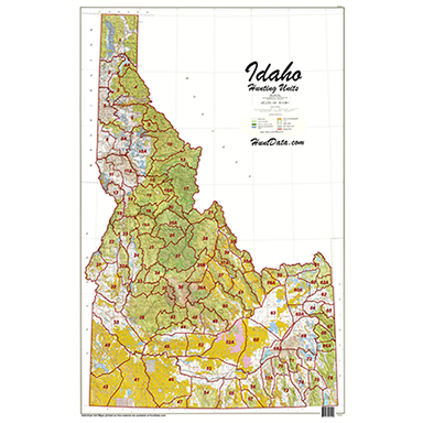
Idaho Statewide BLM BigGame General Unit Map with Land Status
Statewide 1:500,000 Land Ownership Map displaying the general unit boundaries. BLM, National Forest, State and private lands color coded to give give you an idea of the public lands available for your hunt! The map is printed on our rugged material to last for years. Hang it in the den or at the office to spawn plans and feed hunting dreams!
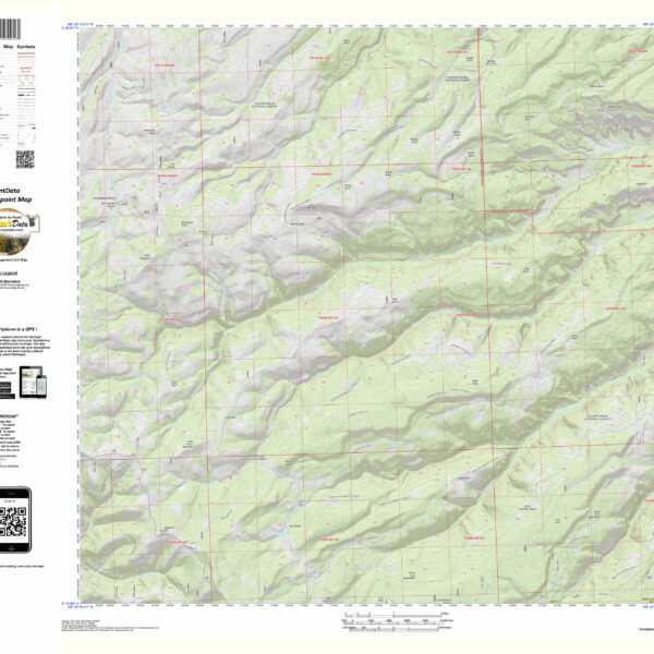
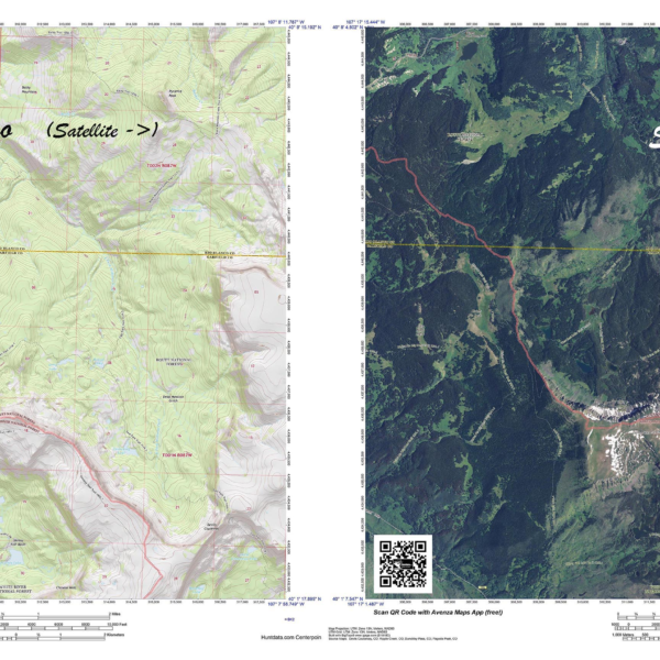
CO Sheep Centerpoint Custom 7.5 minute Maps.
On the 7.5 minute maps we project the boundaries along with BigHorn Sheep Kill Sites color coded by sex and year. We'll can create a digital image of your custom map. Add it after you select your unit. The digital maps work in 3D in Google Earth, in new Garmin's with Custom Map capabilities, and in your iPhone or iPad. Truly a must have for a once-in-a-lifetime hunt.
Select options
This product has multiple variants. The options may be chosen on the product page
Arizona Centerpoint.
Nevada Centerpoint – the most detailed map available
