


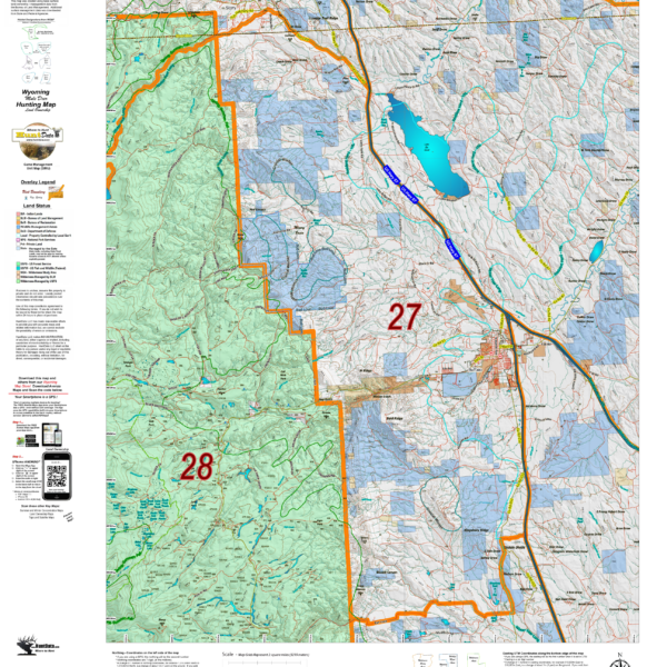
Wyoming Mule Deer Land Ownership and Concentrations combined into one Hybrid map
Over the years this has been our #1 requested map. This year, we used 5 different software processes to create the Wyoming Deer Hybrid Map. This map is built on our NEW Land Ownership Maps. We then overlay a 7.5 minute (Quads) road layer from the USGS, add National Forest Roads, add lakes and streams from the USGS and then add the Wyoming Parks and Wildlife summer, winter, and resident herd, migration routes and corridors for deer. This map has it all. Its all printed on our rugged map fabric. The fabric has a translucency that brings the colors and information to life! This is truly the most comprehensive map we’ve produced in the past 25 years. Click on the small map at left to see a larger sample. Then, scroll to the bottom to order. Click Here to see the Wyoming Deer GMU Reference Map.
Will you be hunting Elk? Be sure to checkout our NEW! Wyoming Elk Land Ownership and Concentrations combined into one Hybrid map.
Will you be hunting Antelope? Be sure to checkout our NEW! Wyoming Antelope Land Ownership and Concentrations combined into one Hybrid map.
Select options
This product has multiple variants. The options may be chosen on the product page
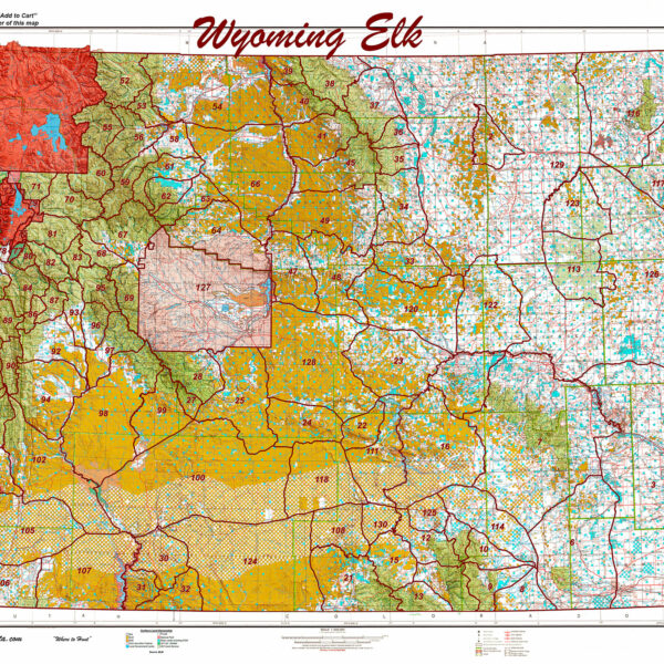
Wyoming Printed Statewide Elk
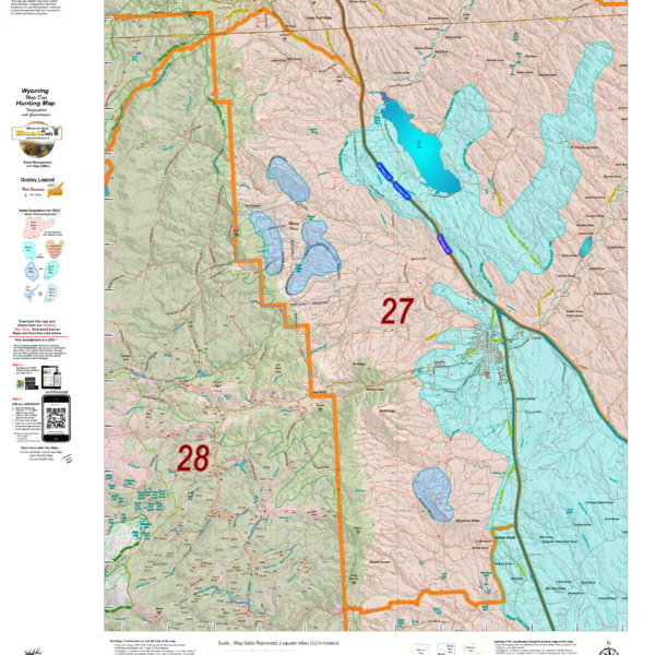
Wyoming Elk Land Ownership and Concentrations combined into one Hybrid map.
Over the years this has been our #1 requested map. This year, we used 5 different software processes to create the Colorado Elk Hybrid Map. This map is built on our NEW Land Ownership Maps. We then overlay a 7.5 minute (Quads) road layer from the USGS, add National Forest Roads, add lakes and streams from the USGS and then add the Colorado Parks and Wildlife summer, winter, and resident herd, migration routes and corridors for elk. For Mule Deer, we add summer and winter concentration areas. This map has it all. Its all printed on our rugged map fabric. The fabric has a translucency that brings the colors and information to life! This is truly the most comprehensive map we've produced in the past 25 years. Click on the small map at left to see a larger sample. Then, scroll to the bottom to order. Click Here to see the Wyoming Elk GMU Reference Map.
Will you be hunting Deer? Be sure to checkout our NEW! Wyoming Deer Land Ownership and Concentrations combined into one Hybrid map.
Will you be hunting Antelope? Be sure to checkout our NEW! Wyoming Antelope Land Ownership and Concentrations combined into one Hybrid map.
Select options
This product has multiple variants. The options may be chosen on the product page
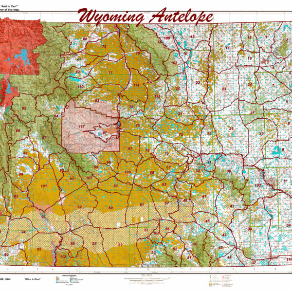
Wyoming Statewide Antelope Unit Map
Wyoming Antelope Land Ownership and Habitat Hybrid
A great antelope map built on a landownership base with summer and winter concentration overlay data. The map provides everything you need for success. As with all of your Hybrid maps, they are printed on our rugged fabric material. Click Here to see the Wyoming Antelope GMU Reference Map
Select options
This product has multiple variants. The options may be chosen on the product page
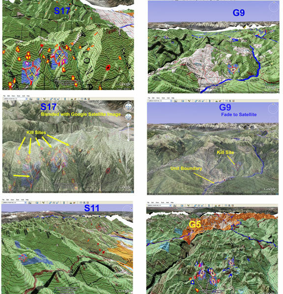
CO Mountain Goat 3D Scouting Maps!
3D Google Earth maps of any Mountain Goat Unit! The maps (3) are exact copies of the Land Ownership and Satellite Images with kill sites and drainages, concentration areas, public, and private land.
Select options
This product has multiple variants. The options may be chosen on the product page
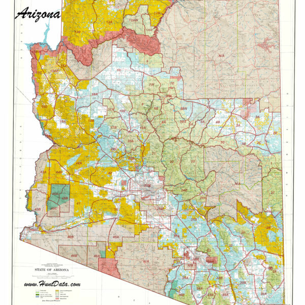
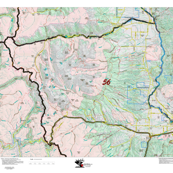
Arizona Printed Statewide Unit Map
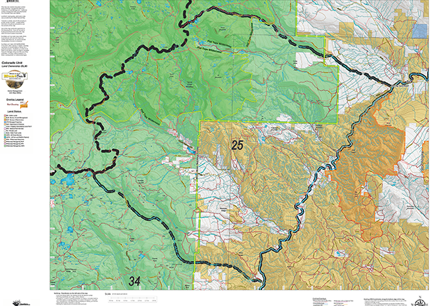
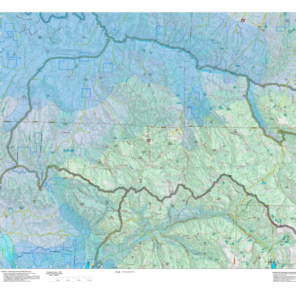
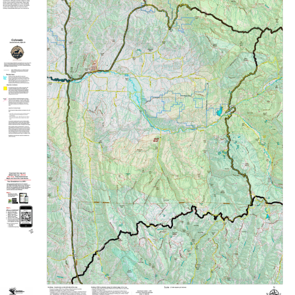
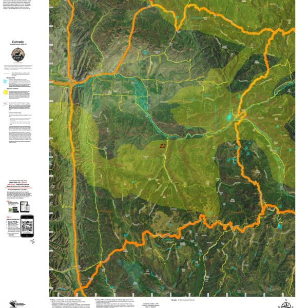
CO Land Ownership with Elk Concentrations
Over the years this has been our #1 requested map. This year, we used 5 different software processes to create
Select options
This product has multiple variants. The options may be chosen on the product page
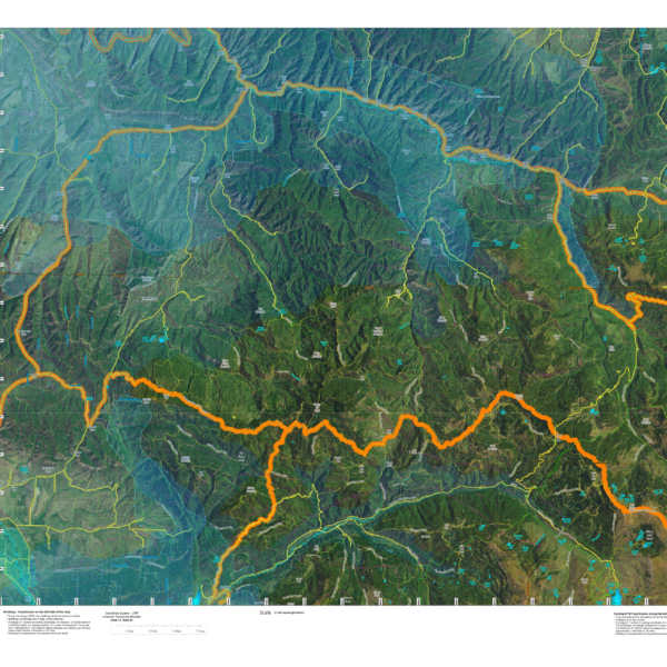
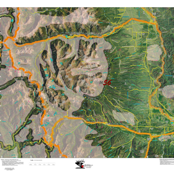
CO Satellite with Land Ownership AND Elk Concentrations.
NEW! This map takes 6 different software programs to develop. We use an enhanced set of Satellite Images, project Land
Select options
This product has multiple variants. The options may be chosen on the product page
HuntAI – 3rd, 4th, and Late Season Recommendations
Elk Concentration Maps were invented by HuntData. These maps have been our best sellers over the past 25 years. This year, we updated the styles, enhancing boundaries, clarifying summer, winter, and resident herds, migration routes and adding 7.5-minute roads from the USGS Quad collection. The maps are printed on our rugged map fabric designed to last as long as your hunting memory.
Select options
This product has multiple variants. The options may be chosen on the product page
HuntAI – Second Rifle Recommendations
Elk Concentration Maps were invented by HuntData. These maps have been our best sellers over the past 25 years. This year, we updated the styles, enhancing boundaries, clarifying summer, winter, and resident herds, migration routes and adding 7.5-minute roads from the USGS Quad collection. The maps are printed on our rugged map fabric designed to last as long as your hunting memory.
Select options
This product has multiple variants. The options may be chosen on the product page
HuntAI – First Rifle Recommendations
Elk Concentration Maps were invented by HuntData. These maps have been our best sellers over the past 25 years. This year, we updated the styles, enhancing boundaries, clarifying summer, winter, and resident herds, migration routes and adding 7.5-minute roads from the USGS Quad collection. The maps are printed on our rugged map fabric designed to last as long as your hunting memory.
Select options
This product has multiple variants. The options may be chosen on the product page