


Idaho Bear Land Ownership Maps.
The Land Ownership Maps are built using land ownership data from USGS, National Forest and the State. We add current location data, streams, lakes, roads and trails from the USGS 7.5 minute Quad Map data set then print it on our rugged map fabric to create the best map in the industry. Click on the small map at left to see a larger sample. Scroll to the bottom of the map to order then move to the bottom right to Add To Cart.
Idaho Bighorn Sheep Unit Maps
The Land Ownership Maps are built using land ownership data from USGS, National Forest and the State. We add current location data, streams, lakes, roads and trails from the USGS 7.5 minute Quad Map data set then print it on our rugged map fabric to create the best map in the industry. Click on the small map at left to see a larger sample. Scroll to the bottom of the map to order then move to the bottom right to Add To Cart.
Idaho Elk Controlled Hunt Maps.
The Land Ownership Maps are built using land ownership data from USGS, National Forest and the State. We add current location data, streams, lakes, roads and trails from the USGS 7.5 minute Quad Map data set then print it on our rugged map fabric to create the best map in the industry. Other maps you see online are created from scanned BLM maps. The scanned maps from the BLM area great but many are 5 or more years old. Our maps are built from the ground up with current data. We use several different software programs to handle the complexity and publication of these maps. These maps are printed on our rugged map fabric to create a map that will last as long as your memories! Choose a unit below then move to the bottom right and click ADD to CART to order your map.
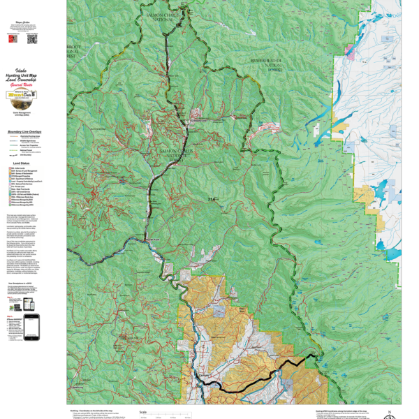
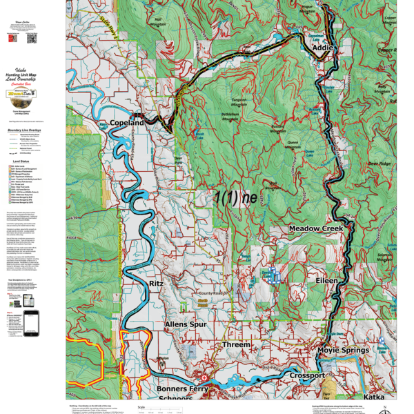
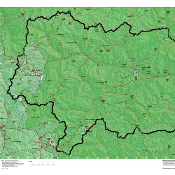
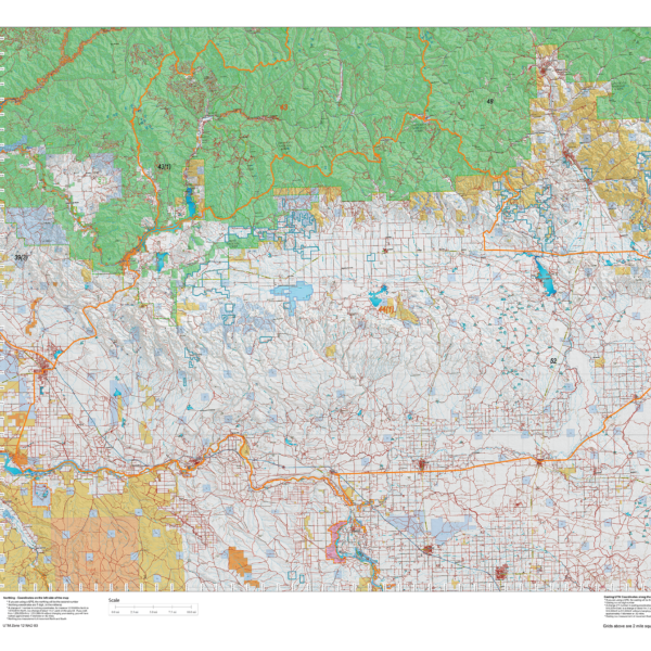
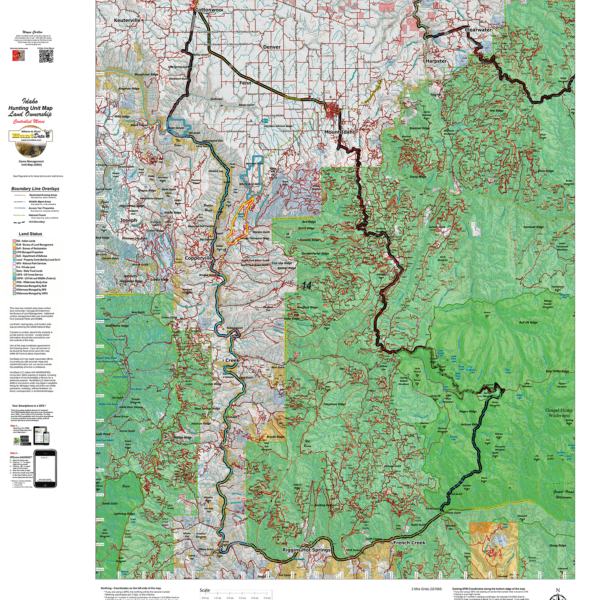
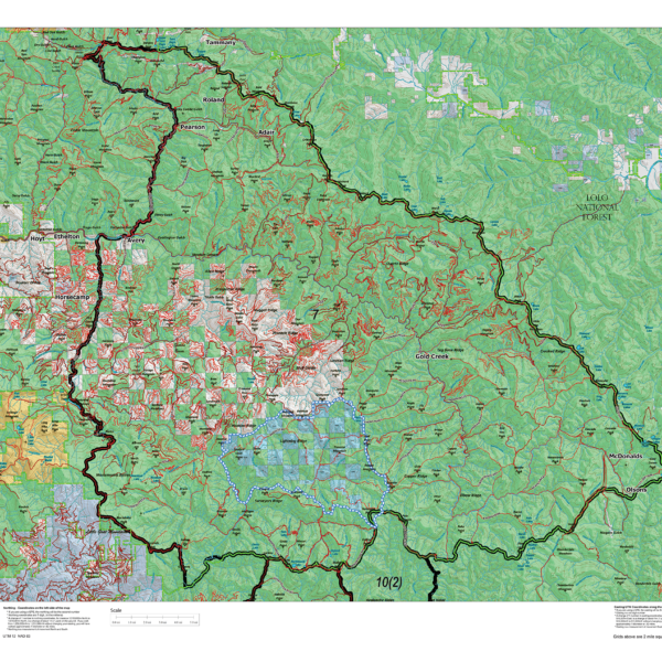
Idaho General Land Ownership Hunting Unit Maps.
The Land Ownership Maps are built using land ownership data from USGS, National Forest and the State. We add current location data, streams, lakes, roads and trails from the USGS 7.5 minute Quad Map data set then print it on our rugged map fabric to create the best map in the industry. Click on the small map at left to see a larger sample. Scroll to the bottom of the map to order then move to the bottom right to Add To Cart.
Idaho Moose Unit Maps.
The Land Ownership Maps are built using land ownership data from USGS, National Forest and the State. We add current location data, streams, lakes, roads and trails from the USGS 7.5 minute Quad Map data set then print it on our rugged map fabric to create the best map in the industry. Click on the small map at left to see a larger sample. Scroll to the bottom of the map to order then move to the bottom right to Add To Cart.
Idaho Mountain Goat Unit Maps.
The Land Ownership Maps are built using land ownership data from USGS, National Forest and the State. We add current location data, streams, lakes, roads and trails from the USGS 7.5 minute Quad Map data set then print it on our rugged map fabric to create the best map in the industry. Click on the small map at left to see a larger sample. Scroll to the bottom of the map to order then move to the bottom right to Add To Cart.
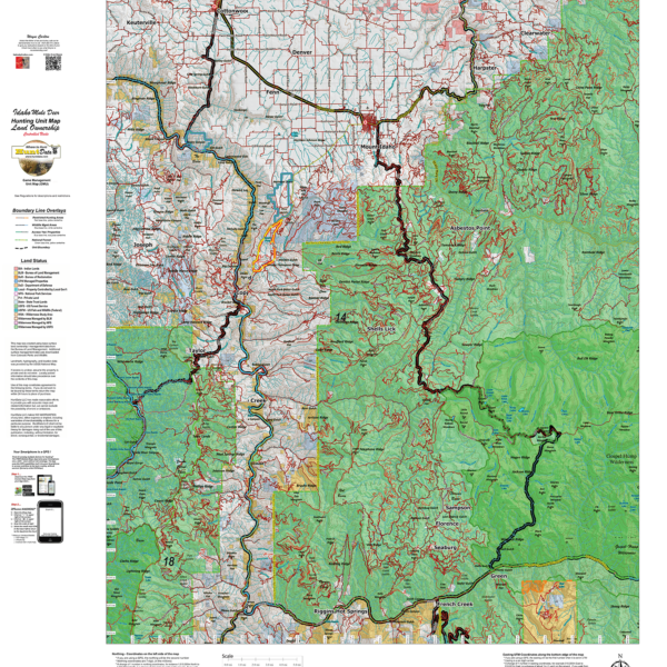
Idaho Mule Deer Land Ownership Maps for Controlled Hunts.
The Land Ownership Maps are built using land ownership data from USGS, National Forest and the State. We add current location data, streams, lakes, roads and trails from the USGS 7.5 minute Quad Map data set then print it on our rugged map fabric to create the best map in the industry. Click on the small map at left to see a larger sample. Scroll to the bottom of the map to order then move to the bottom right to Add To Cart.
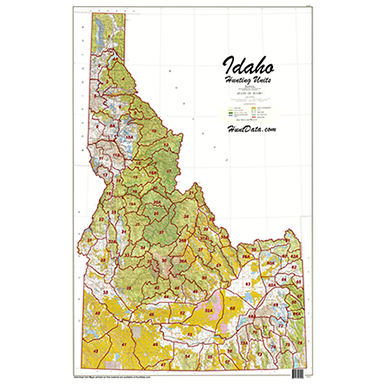
Idaho Statewide BLM BigGame General Unit Map with Land Status
Statewide 1:500,000 Land Ownership Map displaying the general unit boundaries. BLM, National Forest, State and private lands color coded to give give you an idea of the public lands available for your hunt! The map is printed on our rugged material to last for years. Hang it in the den or at the office to spawn plans and feed hunting dreams!
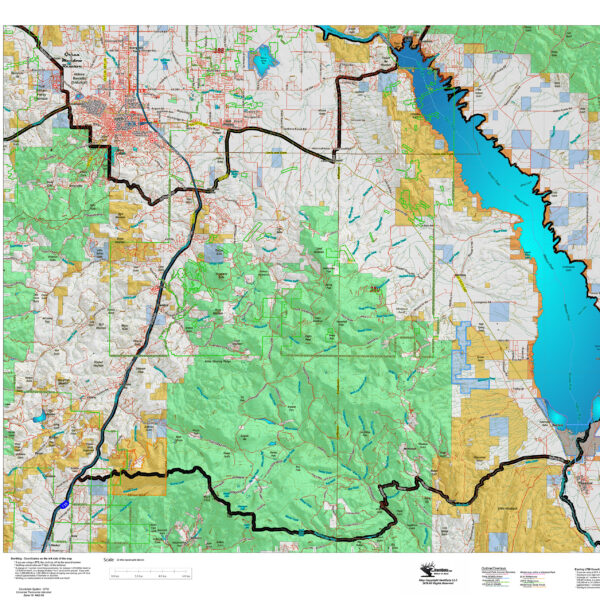
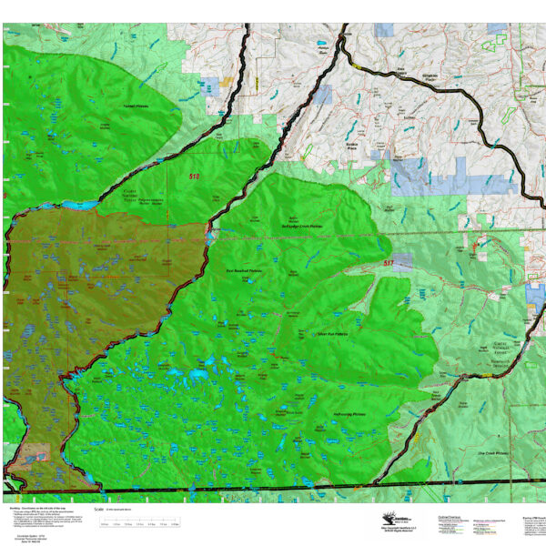
Montana Antelope District Land Ownership Maps
Custom maps built from the ground up using the latest BLM Land Status information, USGS 7.5 minute roads, National Forest, State, and other land ownership information with the latest Bighorn Sheep District boundary and portion (restrictions or closed) highlights. All printed on our rugged map fabric to creating a vibrant, long-lasting map.
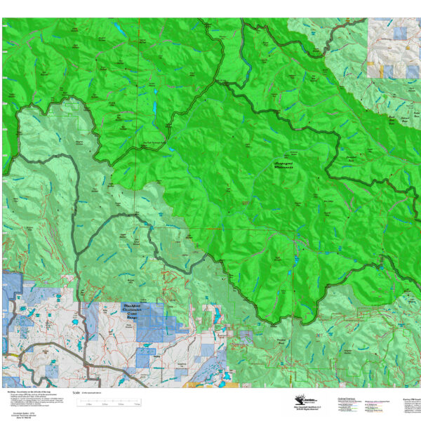
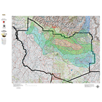
Montana Bighorn Sheep District Land Ownership Maps
Custom maps built from the ground up using the latest BLM Land Status information, USGS 7.5 minute roads, National Forest, State, and other land ownership information with the latest Bighorn Sheep District boundary and portion (restrictions or closed) highlights. All printed on our rugged map fabric to creating a vibrant, long-lasting map.
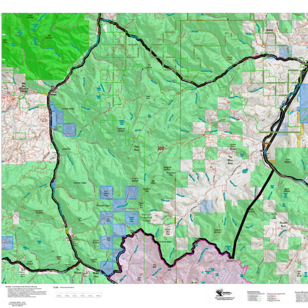
Montana Elk District Land Ownership Maps
Custom maps built from the ground up using the latest BLM Land Status information, USGS 7.5 minute roads, National Forest, State, and other land ownership information with the latest Bighorn Sheep District boundary and portion (restrictions or closed) highlights. All printed on our rugged map fabric to creating a vibrant, long-lasting map.
Montana Moose District Land Ownership Maps
Custom maps built from the ground up using the latest BLM Land Status information, USGS 7.5 minute roads, National Forest, State, and other land ownership information with the latest Moose District boundary and portion (restrictions or closed) highlights. All printed on our rugged map fabric to creating a vibrant, long-lasting map.
Montana Mountain Goat District Land Ownership Maps
Custom maps built from the ground up using the latest BLM Land Status information, USGS 7.5 minute roads, National Forest, State, and other land ownership information with the latest Mountain Goat District boundary and portion (restrictions or closed) highlights. All printed on our rugged map fabric to creating a vibrant, long-lasting map.
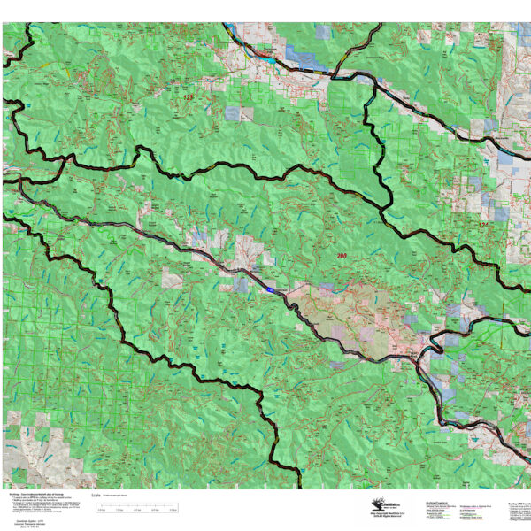
Montana Mule Deer District Land Ownership Maps
Custom maps built from the ground up using the latest BLM Land Status information, USGS 7.5 minute roads, National Forest, State, and other land ownership information with the latest Mule Deer District boundary and portion (restrictions or closed) highlights. All printed on our rugged map fabric to creating a vibrant, long-lasting map.
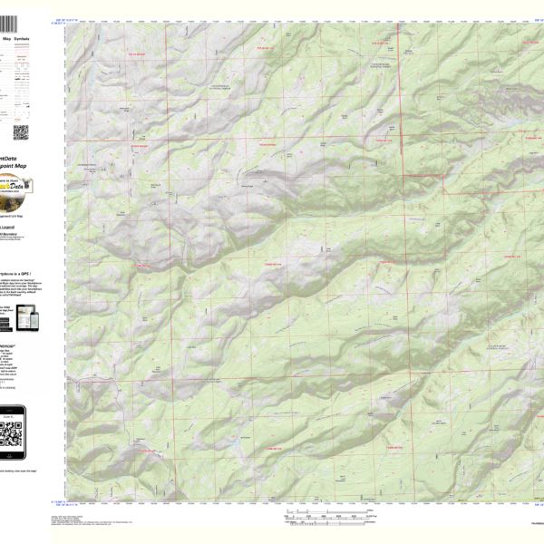
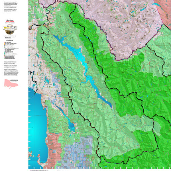
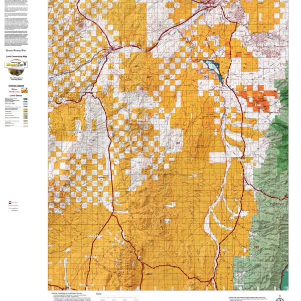
MT Centerpoint Coordinates.
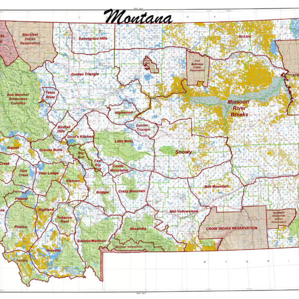
Mt. State Unit Map.
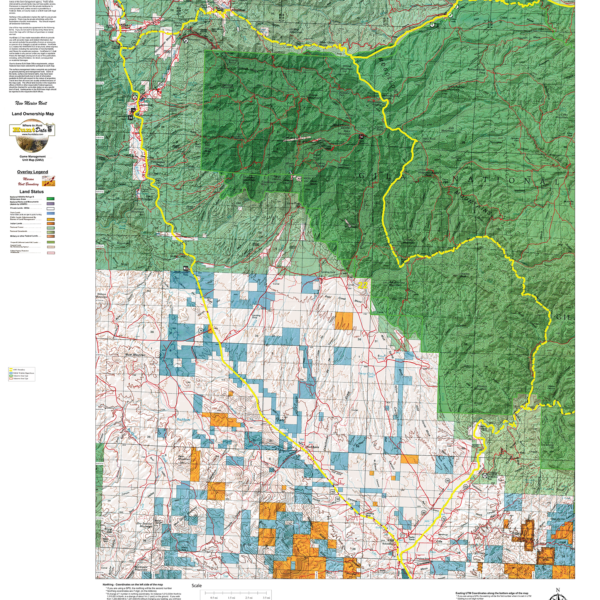
Nevada Centerpoint – the most detailed map available
Nevada Land Ownership Unit Map
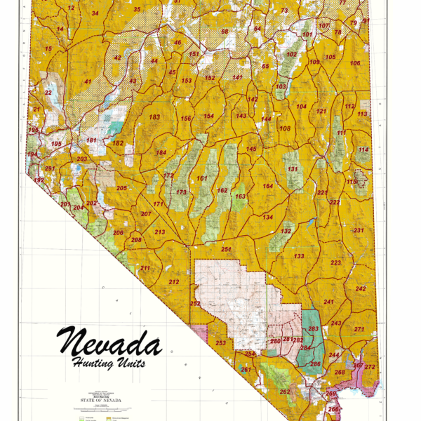
Nevada Statewide Unit Map

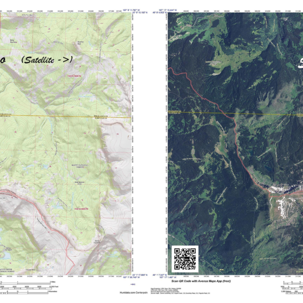
New Mexico 7.5 Minute Centerpoint – the most detailed map available
Have you zeroed in on a hunting spot? A Centerpoint Map is what you need! Give us coordinates of your centerpoint and we’ll build a 7.5 minute (1:24,000) Have you zeroed in on a hunting spot? A Centerpoint Map is what you need! Give us coordinates of your centerpoint and we’ll build a 7.5 minute (1:24,000) map around the map stretching 4 miles in each direction (8 x 8 miles total). We will use the based maps from the USGS 7.5 minute Quad Topo or Satellite series, add unit boundaries and private land. You will end up with the most detailed map available. Type your coordinates in the box below and we’ll build the map. Please note the unit you are hunting in for our build reference. The map will be printed on our rugged tear and water resistant fabric. You will love this map.
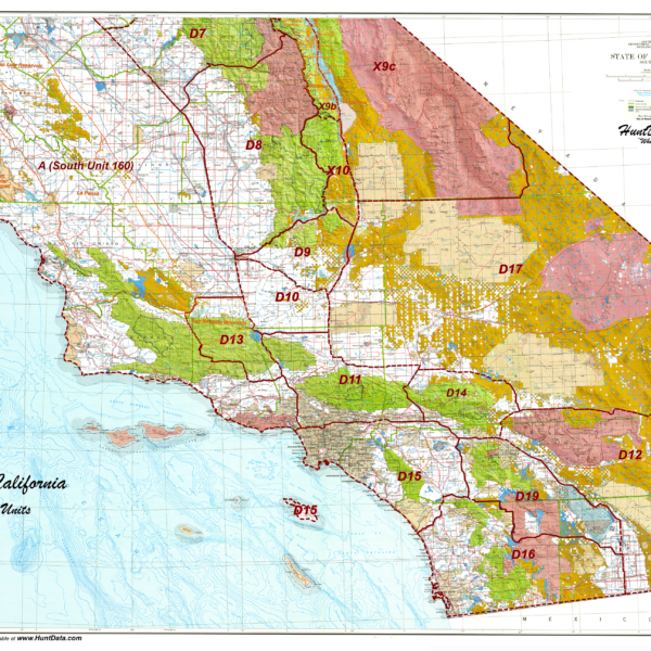
New Mexico Land Ownership Unit Map.
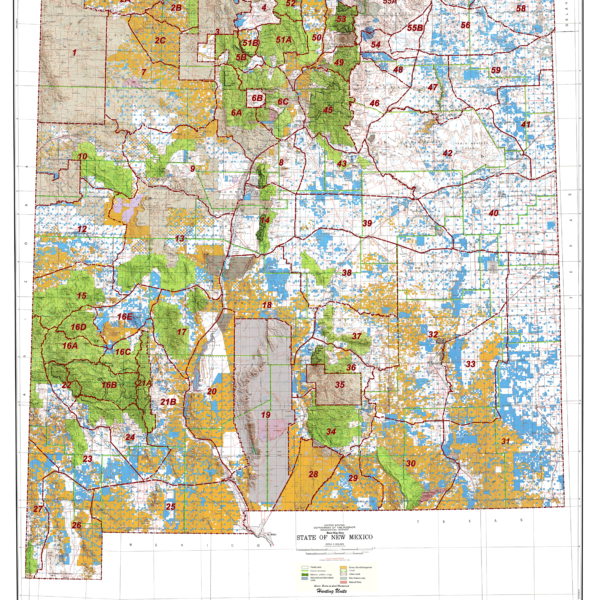
New Mexico Statewide Unit Map.
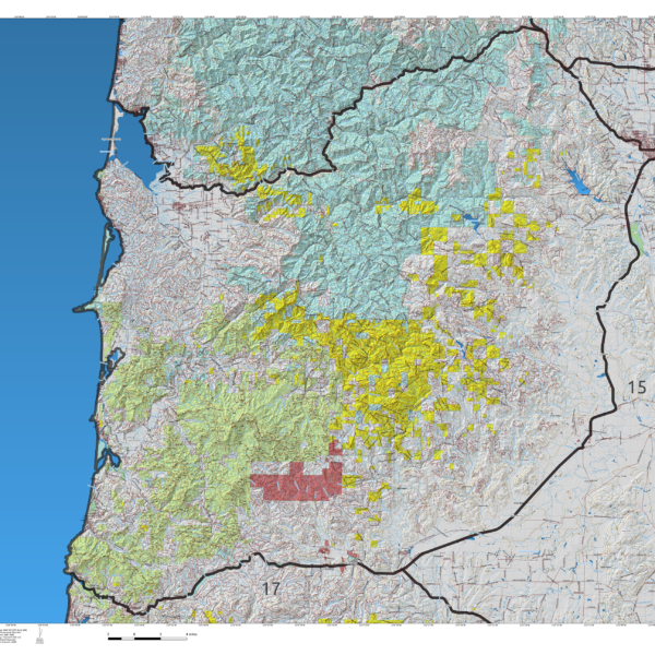
No Cal Deer
We project Summer, Winter, and Fall Concentration data over a Topo base to create a informative and colorful concentration map. We've added detailed water tank locations with roads and trails from the USGS 7.5min Quad series. The maps will help you determine where you SHOULD be hunting in your unit. This map should be part of your hunting tool kit! Click on the small unit at left to see a sample map. Move to the bottom of the sample map to choose a unit, then to the bottom right to Add To Cart.
No Cal Elk
We project Summer, Winter, and Fall Concentration data over a Topo base to create a informative and colorful concentration map. We've added detailed water tank locations with roads and trails from the USGS 7.5min Quad series. The maps will help you determine where you SHOULD be hunting in your unit. This map should be part of your hunting tool kit! Click on the small unit at left to see a sample map. Move to the bottom of the sample map to choose a unit, then to the bottom right to Add To Cart.
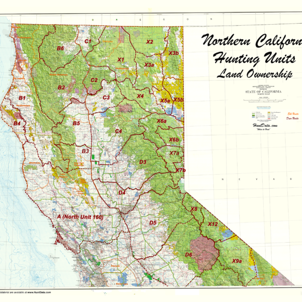
Northern California Zone Map.
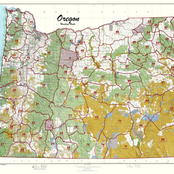
Oregon Statewide Unit Map.
Oregon Unit Land Ownership Maps.
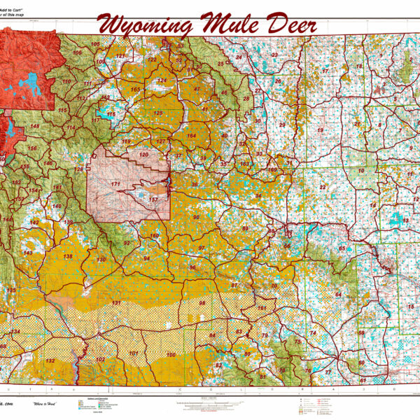
Printed Wyoming Statewide Mule Deer Unit Map.

Save with CO Bighorn Sheep 3D and Printed Map Combo’s
Save with Goat Map Combinations
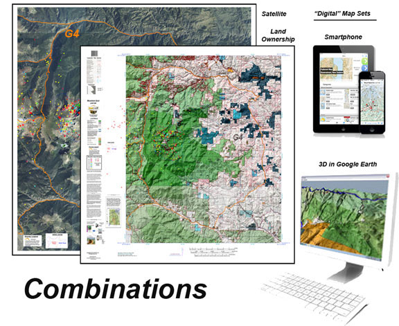
This combo includes one, two, or 3 printed custom maps with roads and trails extracted from the USGS 7.5 minute Quad maps. The land ownership maps are built using current land ownership data from the BLM identifying private, BLM, National Forest, CPW and other public land parcels. The Land Ownership and Satellite maps have plotted kill sites and drainages with summer and winter concentrations. The kill sites are color coded by year. The Topo Map provides a traditional Topo view with unit boundaries and the shaded green vegetation.
The 3D maps can be opened in Google Earth. The Digital maps (3) are exact copies of the printed maps.
So Cal Elk
We project Summer, Winter, and Fall Concentration data over a Topo base to create a informative and colorful concentration map. We've added detailed water tank locations with roads and trails from the USGS 7.5min Quad series. The maps will help you determine where you SHOULD be hunting in your unit. This map should be part of your hunting tool kit! Click on the small unit at left to see a sample map. Move to the bottom of the sample map to choose a unit, then to the bottom right to Add To Cart.
Southern California Zone Map.
The Guide Pack – 4 Maps, Save $40 Elk Concentration, Land Ownership, Topo, Satellite Elk Concentration
Land Ownership, Elk Concentration, and Topo Map. PLUS, the most unique map we've ever created, the Satellite Elk Concentration Map. The Land Ownership, Elk Concentration Maps and Satellite Maps are printed on our rugged fabric material, the Topo is more compact and printed on our water and tear-resistant paper. The Guide Pack is ideal for your hunting group!
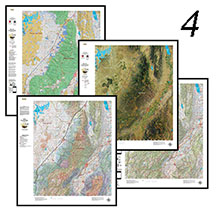
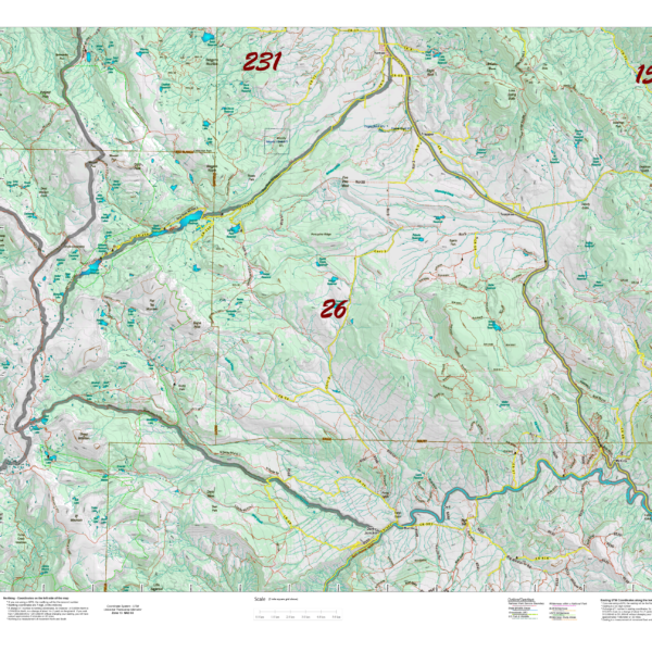
UT Antelope Concentration Map.
We project Summer, Winter, and Fall Concentration data over a Topo base to create an informative and colorful concentration map. Click on the small map at left to see a larger sample. Scroll to the bottom of the map to order then move to the bottom right to Add To Cart. The maps are designed to help you determine where you SHOULD be hunting in your unit during your season. These maps are built on the USGS 1:100,000 base Topo series with enhanced Lakes, Roads and Trails from the USGS 7.5 minute Quad Maps. This map should be part of your hunting tool kit!

UT Antelope Hunting Pack.
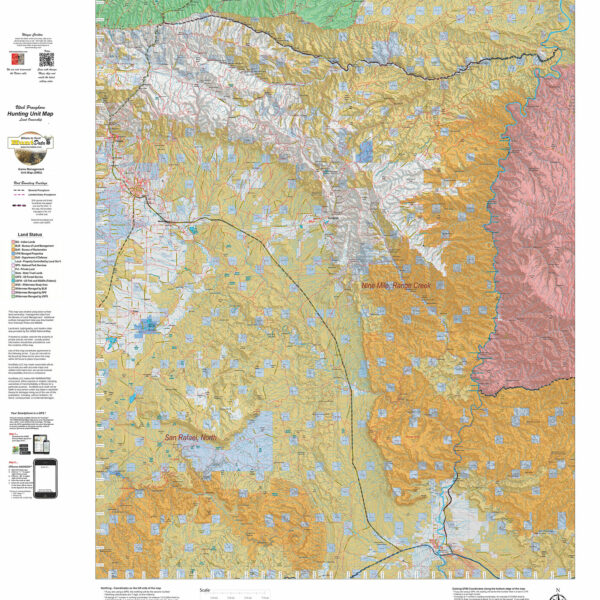
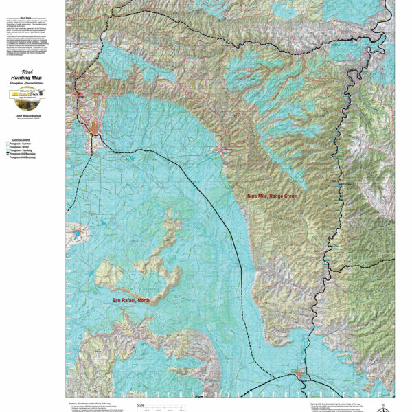
UT Antelope Land Ownership Maps.
We project Summer, Winter, and Fall Concentration data over a Topo base to create an informative and colorful concentration map. Click on the small map at left to see a larger sample. Scroll to the bottom of the map to order then move to the bottom right to Add To Cart. The maps are designed to help you determine where you SHOULD be hunting in your unit during your season. These maps are built on the USGS 1:100,000 base Topo series with enhanced Lakes, Roads and Trails from the USGS 7.5 minute Quad Maps. This map should be part of your hunting tool kit!