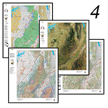
UT Antelope Hunting Pack.
Get all 4 great maps, Land Ownership, Habitat, Satellite and Satellite. The first 3 are printed on our rugged map fabric. The Topo map is printed on our tear and water resistant paper. The ultimate pack of maps for your hunt.
Select options
This product has multiple variants. The options may be chosen on the product page
UT Antelope Land Ownership Maps.
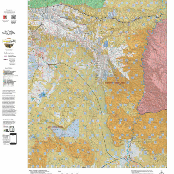
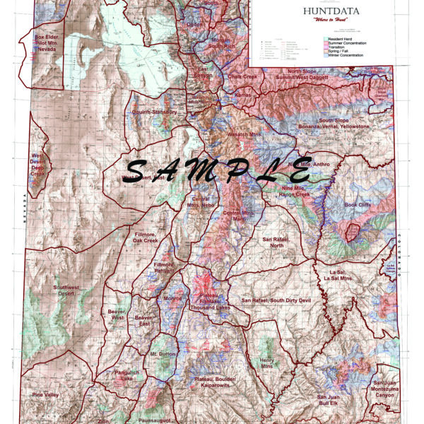
We project Summer, Winter, and Fall Concentration data over a Topo base to create an informative and colorful concentration map. Click on the small map at left to see a larger sample. Scroll to the bottom of the map to order then move to the bottom right to Add To Cart. The maps are designed to help you determine where you SHOULD be hunting in your unit during your season. These maps are built on the USGS 1:100,000 base Topo series with enhanced Lakes, Roads and Trails from the USGS 7.5 minute Quad Maps. This map should be part of your hunting tool kit!
Select options
This product has multiple variants. The options may be chosen on the product page
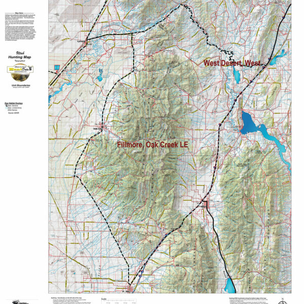
UT Antelope Topo Unit Map.
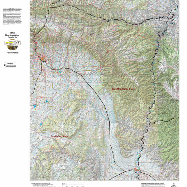
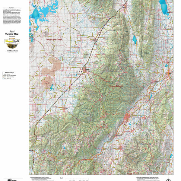
We redesigned our Topo series this year adding updated roads from the USGS 7.5 minute map series to the 1:100, 000 Topo base. Click on the small map at left to see a larger sample. Scroll to the bottom of the map to order then move to the bottom right to Add To Cart. We also enhanced the Forest Service boundries. The result is a traditional topo map with current info! A great tool for your hunt.
Select options
This product has multiple variants. The options may be chosen on the product page
UT Elk Habitat Map.
We project Summer, Winter, and Fall Concentration data over a Topo base to create an informative and colorful concentration map. Click on the small map at left to see a larger sample. Scroll to the bottom of the map to order then move to the bottom right to Add To Cart. The maps are designed to help you determine where you SHOULD be hunting in your unit during your season. These maps are built on the USGS 1:100,000 base Topo series with enhanced Lakes, Roads and Trails from the USGS 7.5 minute Quad Maps. This map should be part of your hunting tool kit!
Select options
This product has multiple variants. The options may be chosen on the product page
UT Elk Hunting Pack – Order all 4 maps and save $20.
Get all 4 great maps, Land Ownership, Habitat, Satellite and Topo. The first 3 are printed on our rugged map fabric. The Topo map is printed on our tear and water resistant paper. The ultimate pack of maps for your hunt.
Select options
This product has multiple variants. The options may be chosen on the product page
UT Elk Land Ownership Map.
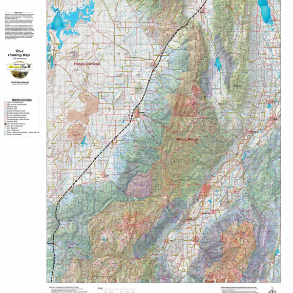
The Land Ownership Maps are built using land ownership data from USGS, National Forest and the State. We add current location data, streams, lakes, roads and trails from the USGS 7.5 minute Quad Map data set then print it on our rugged map fabric to create the best map in the industry. Click on the small map at left to see a larger sample. Scroll to the bottom of the map to order then move to the bottom right to Add To Cart.
Select options
This product has multiple variants. The options may be chosen on the product page
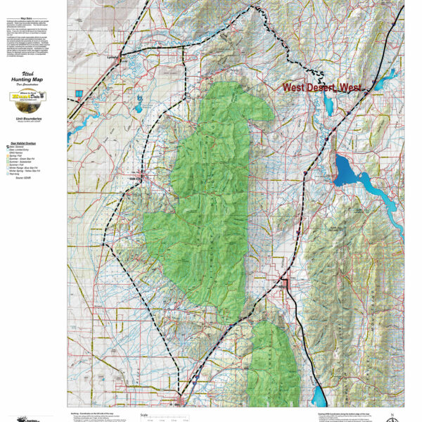
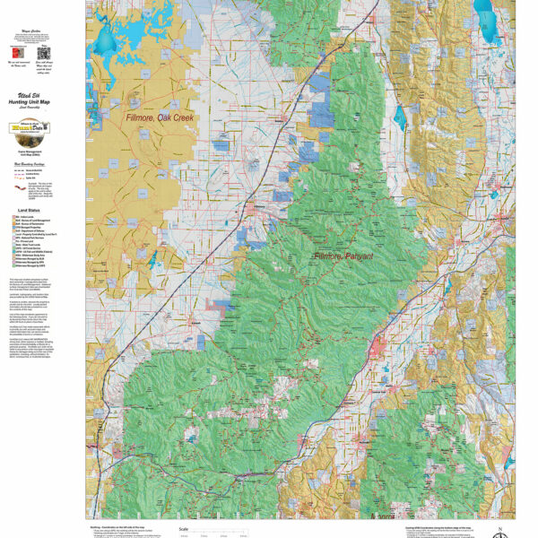
UT Mule Deer Habitat Unit Maps.
We project Summer, Winter, and Fall Concentration data over a Topo base to create an informative and colorful concentration map. Click on the small map at left to see a larger sample. Scroll to the bottom of the map to order then move to the bottom right to Add To Cart. The maps are designed to help you determine where you SHOULD be hunting in your unit during your season. These maps are built on the USGS 1:100,000 base Topo series with enhanced Lakes, Roads and Trails from the USGS 7.5 minute Quad Maps. This map should be part of your hunting tool kit!
Select options
This product has multiple variants. The options may be chosen on the product page
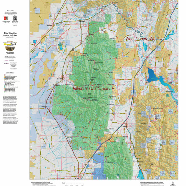
UT Mule Deer Land Ownership Unit Maps.
The Land Ownership Maps are built using land ownership data from USGS, National Forest and the State. We add current location data, streams, lakes, roads and trails from the USGS 7.5 minute Quad Map data set then print it on our rugged map fabric to create the best map in the industry. Click on the small map at left to see a larger sample. Scroll to the bottom of the map to order then move to the bottom right to Add To Cart.
Select options
This product has multiple variants. The options may be chosen on the product page
UT Mule Deer Topo Unit Map.
We redesigned our Topo series this year adding updated roads from the USGS 7.5 minute map series to the 1:100, 000 Topo base. Click on the small map at left to see a larger sample. Scroll to the bottom of the map to order then move to the bottom right to Add To Cart. We also enhanced the Forest Service boundries. The result is a traditional topo map with current info! A great tool for your hunt.
Select options
This product has multiple variants. The options may be chosen on the product page
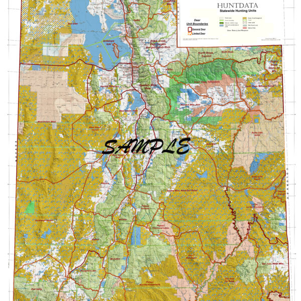
Ut_State_Elk_Concentrations.
UT_State_Mule_Deer.

Utah 4 Map Combo, Save $20.
Get all 4 great maps, Land Ownership, Habitat, Satellite and Topo. The first 3 are printed on our rugged map fabric. The Topo map is printed on our tear and water resistant paper. The ultimate pack of maps for your hunt.
Select options
This product has multiple variants. The options may be chosen on the product page
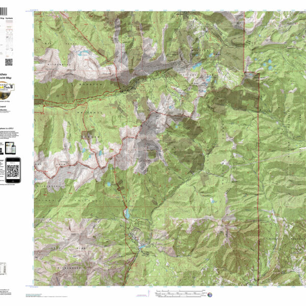
Utah 7.5 minute Custom Hunting Map
Have you zeroed in on a hunting spot? A Centerpoint Map is what you need! Give us coordinates of your centerpoint and we’ll build a 7.5 minute (1:24,000) Have you zeroed in on a hunting spot? A Centerpoint Map is what you need! Give us coordinates of your centerpoint and we’ll build a 7.5 minute (1:24,000) map around the map stretching 4 miles in each direction (8 x 8 miles total). We will use the based maps from the USGS 7.5 minute Quad Topo or Satellite series, add unit boundaries and private land. You will end up with the most detailed map available. Type your coordinates in the box below and we’ll build the map. Please note the unit you are hunting in for our build reference. The map will be printed on our rugged tear and water resistant fabric. You will love this map.
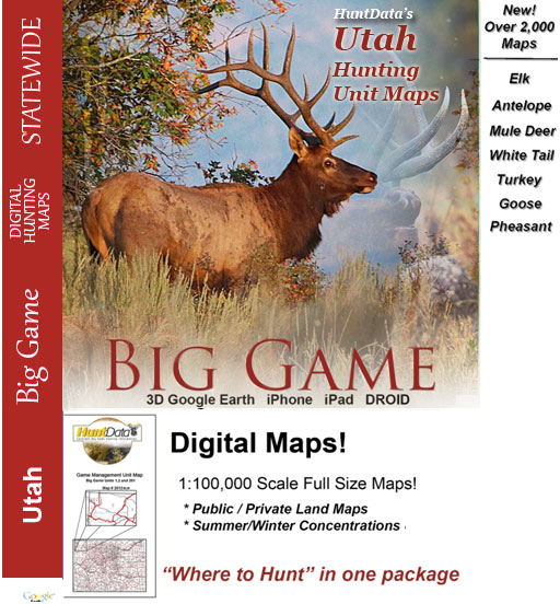
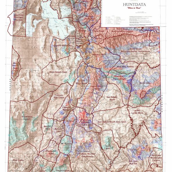
Utah Digital Maps.
Digital Maps for every unit in Utah - use them in 3D in Google Earth or in Avenza Maps App on your iOS, DROID or Windows device!
Select options
This product has multiple variants. The options may be chosen on the product page
Utah Elk Topographical Unit Map
We redesigned our Topo series this year adding updated roads from the USGS 7.5 minute map series to the 1:100, 000 Topo base. Click on the small map at left to see a larger sample. Scroll to the bottom of the map to order then move to the bottom right to Add To Cart. We also enhanced the Forest Service boundries. The result is a traditional topo map with current info! A great tool for your hunt.
Select options
This product has multiple variants. The options may be chosen on the product page
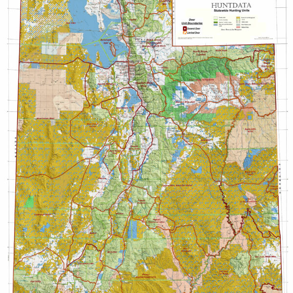
Utah Statewide Elk Concentration Map
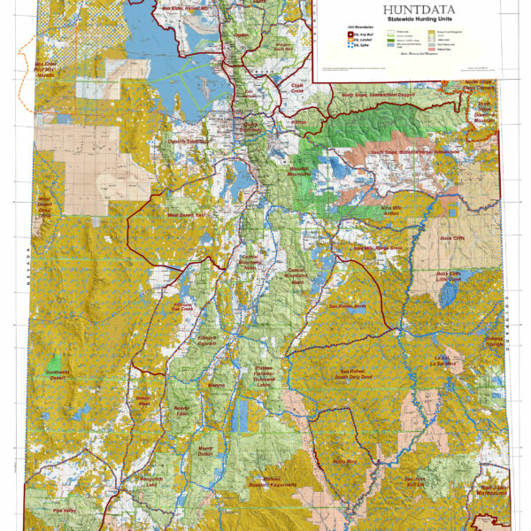
Utah Statewide Elk General Unit Map with Land Ownership